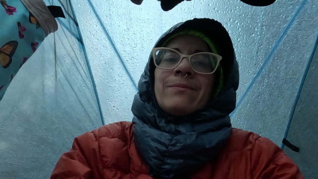
I woke before 5 to the sound of rain pattering on my tent. I went back to sleep, but it was still raining when I woke again around 6, so I used my InReach to check the weather forecast. It was supposed to clearer by around 9, so I decided to hang out in the tent a bit. I only had about 6 miles to hike, so I could afford to start a bit later than usual. Plus, I’d had very little time to read yesterday, so now I could catch up.
This day was July 22nd. Ambrose and I celebrated July 22nd every year as the day that we met in person for the first time. We’d chatted online before that, and even exchanged a phone call or two, but July 22nd was the day we met face to face for the very first time. It was our anniversary. And this was the first one that I spent without him.
For me, there couldn’t have been a better place to be on that first anniversary without him than the woods. And being at Snowslide Lake in particular felt right, especially with the rain falling like teardrops on my tent (Ambrose loved the sound of rain falling on a tent). I learned a lot from that first Snowslide Lake trip, one of our early backpacking trips together. The big lesson, of course, was never to hike past a trail junction without your hiking partner. But I also learned about reading maps, adjusting the trip itinerary, pushing myself physically, and finding trail.
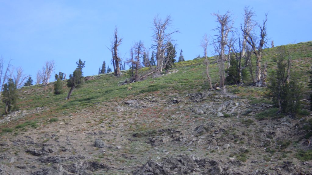
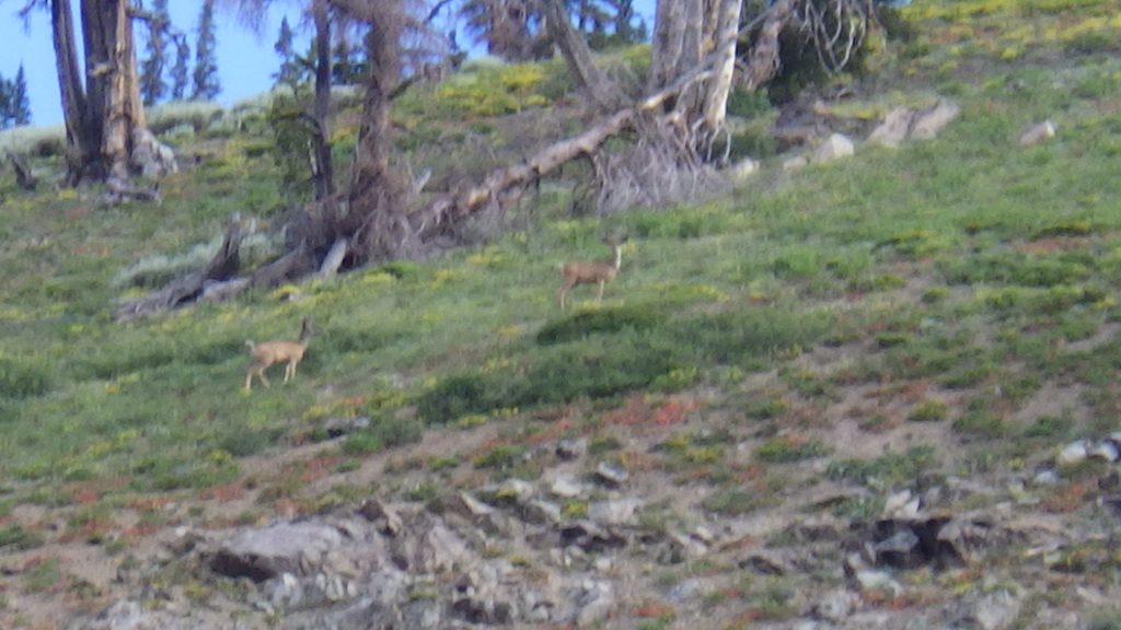
The rain stopped around 7:15, and I was packed up and heading out by 8:30. I stopped at the lake to scatter some of Ambrose’s ashes. As I sang my mantra and let the ashes fall between my fingers into the water, I saw deer running up the slope on the north side of the lake. It felt like an omen or a benediction. I rinsed my hand in the lake and hiked back to the main trail without incident, though I did lose the lake trail so I’m still not sure where it meets up with the main trail.
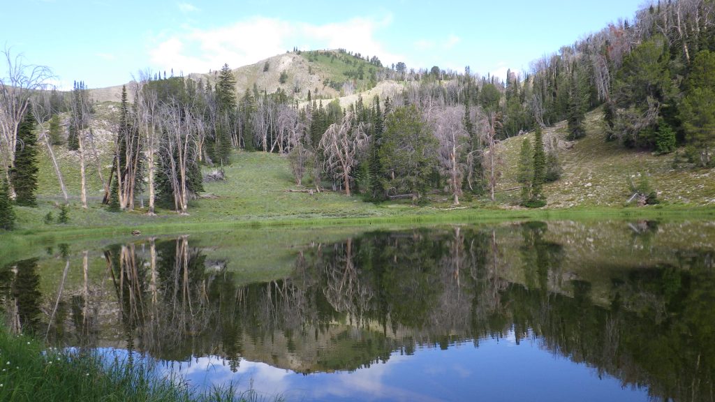
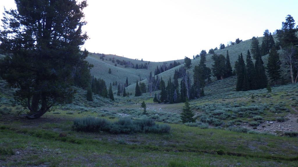
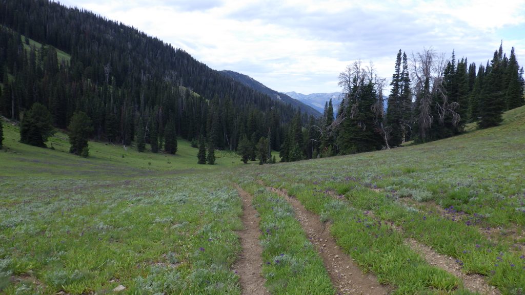
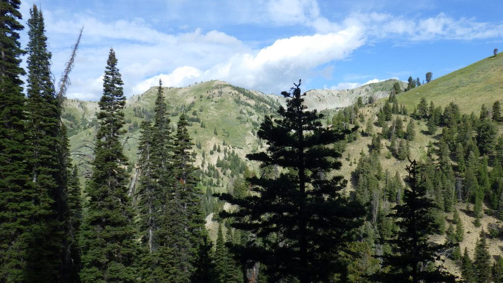
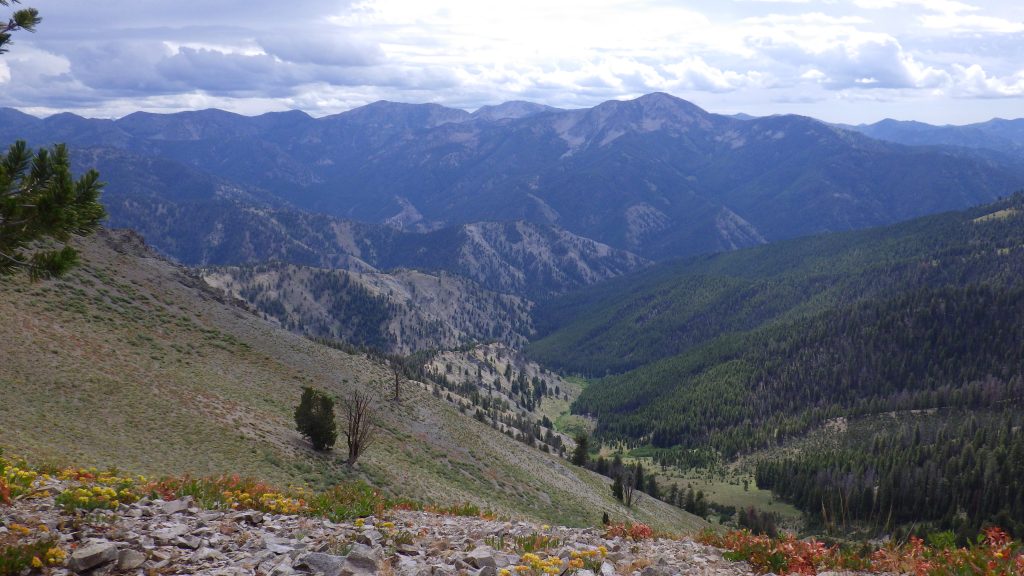
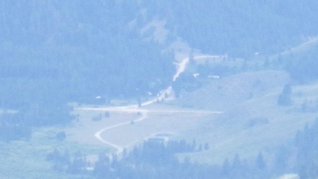
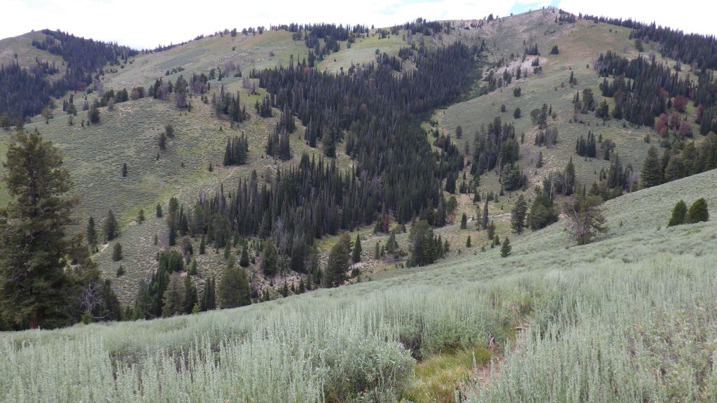
The last time I hiked this trail, the day was very smoky. It was hard to see more distant landmarks, and breathing wasn’t easy with the particulates in the air. On this trip, the air was clear, and fresh from the recent rain. I could see for miles, including over to the valley I’d hiked up the day before to my left.
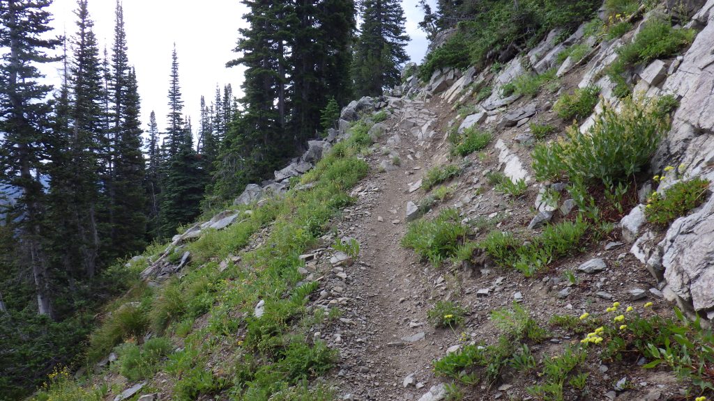
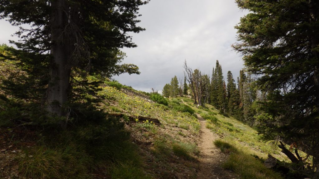
As I hiked, I wondered that Ambrose had managed to hike this section three times in one day and then manage to come back for round four the next day. It was not an easy trail. Mostly downhill going this way, but not completely downhill, and rocky in many sections. And, being open to motorbikes, some of the rocky sections were treacherous with loose rock.
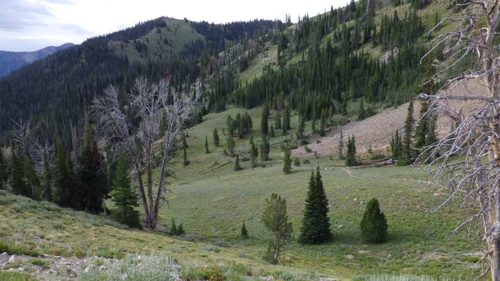
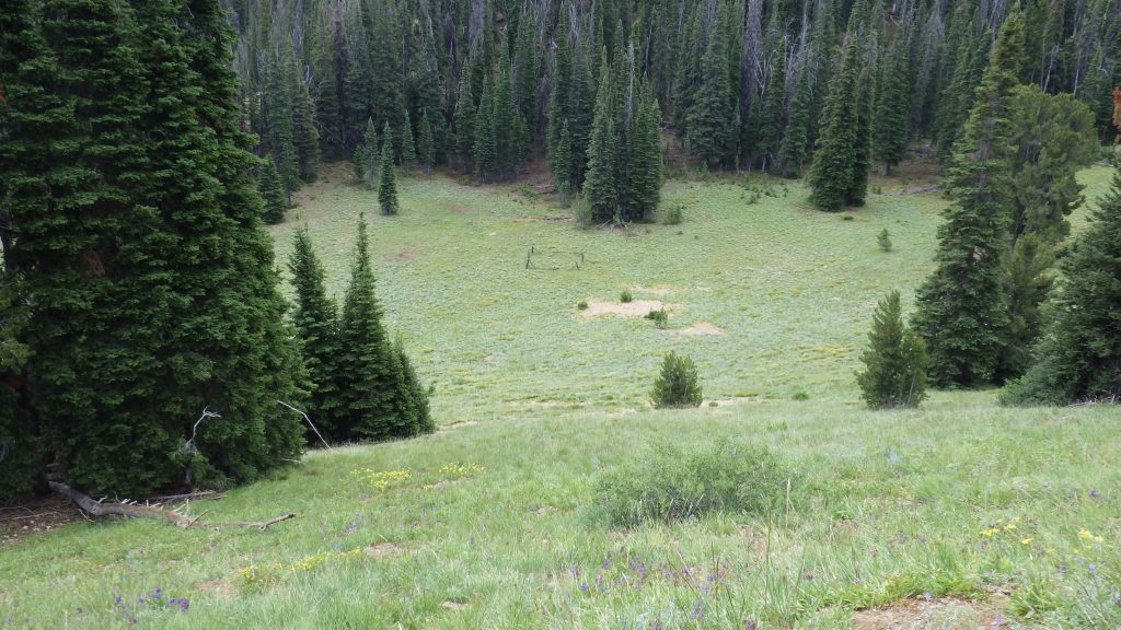
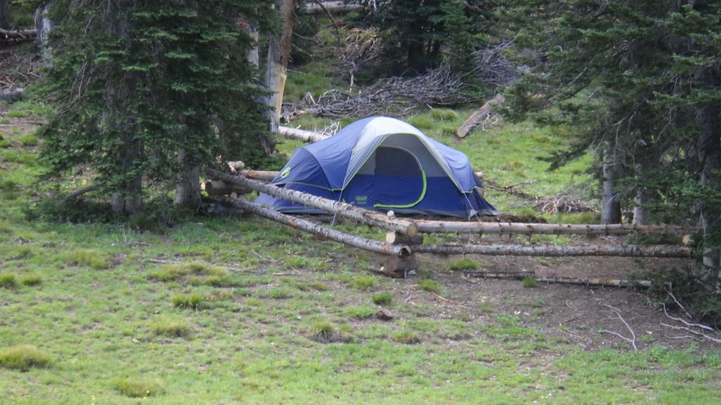
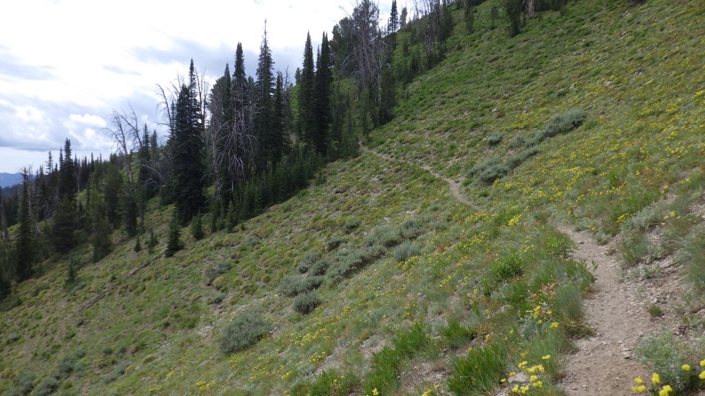
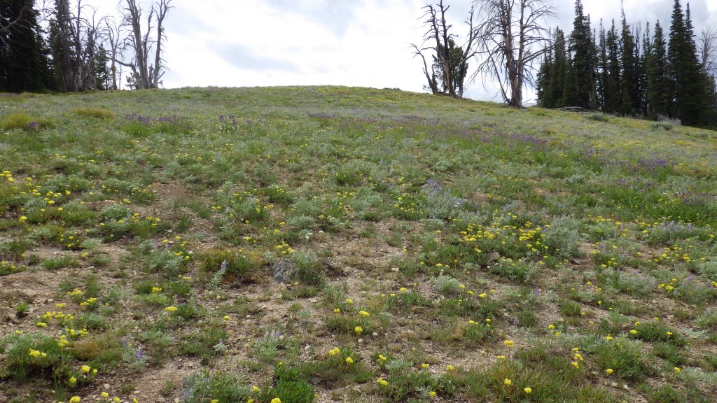
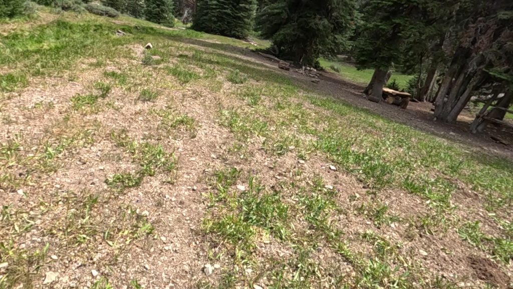
There looked to be a slight reroute to the trail as I switched over to the other side of the ridge; I think it used to go up and over, and now it goes around. Green meadows lay below on the other side of the ridge, and evidence of people with old wooden fencing decaying in place. I passed by what looked like a semi-permanent campsite for horse packers. A 6 to 8 person tent surrounded by wooden fencing, and then another fenced in area further down the trail that was clearly the camp kitchen, complete with places to sit and what looked like a stove in one corner. I had seen fresh horse droppings, I hadn’t seen people or horses.

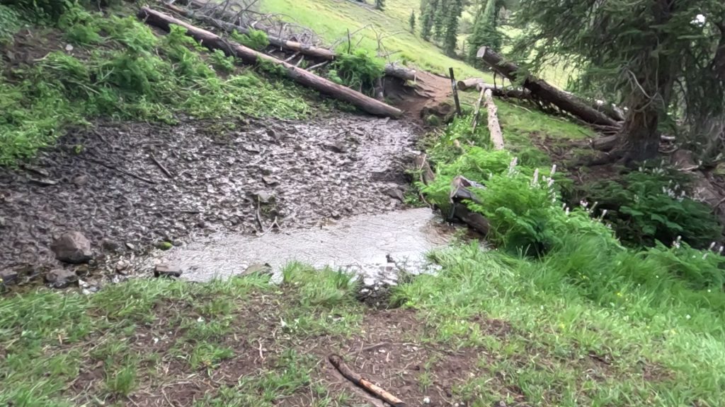
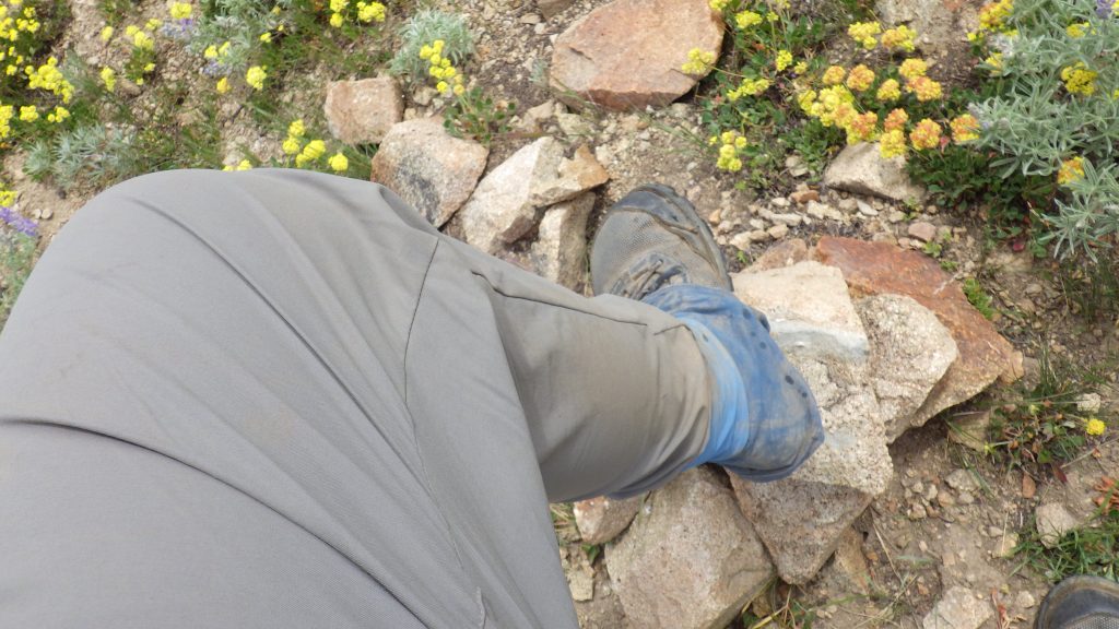
The trail continued to drop down following Paradise Creek (yes, there are two of them on this journey). And then I came to the junction where I had to cross the creek. The far bank looked super muddy, but turned out to be more rocky than muddy. I decided to take my break and get water from the creek to drink instead of using what I was carrying. I didn’t want my excuse for not summiting Skillern Peak to be that I was out of water. For a snack, I had an Embark Coffee Maple. I usually try to only do half of those at once, but this time I did the whole thing. By the time I finished, I was practically vibrating from the caffeine and sugar.
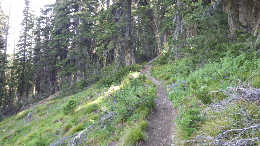
Good thing I had plenty of uphill to burn all that energy on. I’d forgotten just how steep this section of the hike was. Again, I was amazed and proud of how Ambrose and I had done this when we were in not great shape. The trail climbed up the side of the ridge, mostly steep, sometimes not too bad. But all uphill.
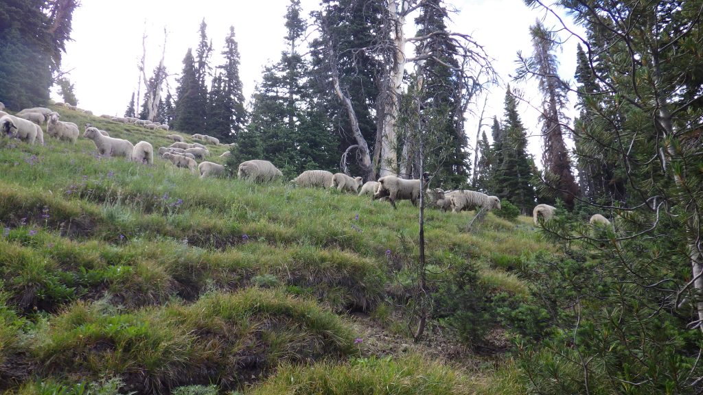
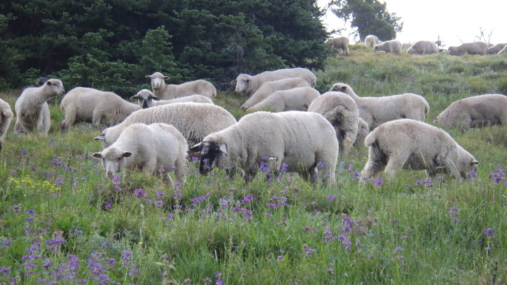
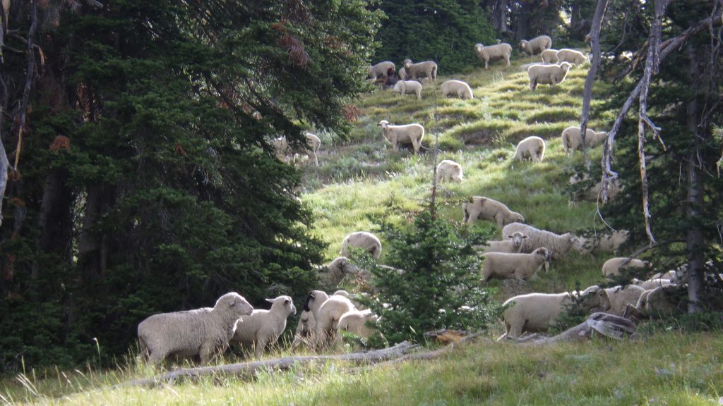
As I got close to the top, I could hear the baaing of sheep. And I thought to myself, that’s why it was raining. Ambrose wanted me to sleep in so that I’d get here, right to this spot, just when the sheep were there, too. It felt like an anniversary gift from him to me.
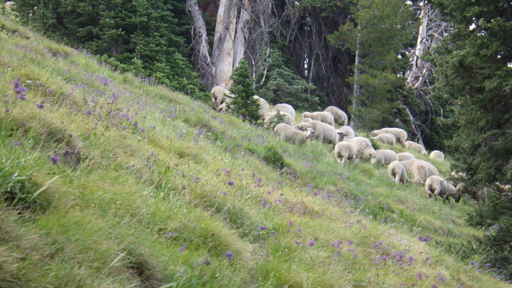
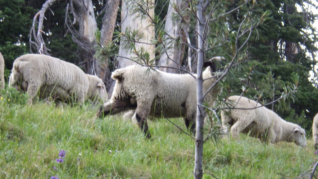
I don’t know how many sheep there were, but there were a lot. I’d have fallen asleep despite the caffeine and sugar if I’d tried to count them. They were just above the trail, so they didn’t spook too much as I hiked along below them. I didn’t see a shepherd, but I did hear a bell, so I figured the shepherd was probably just over the ridgeline. I really enjoyed seeing those sheep.
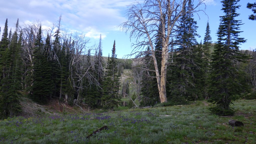
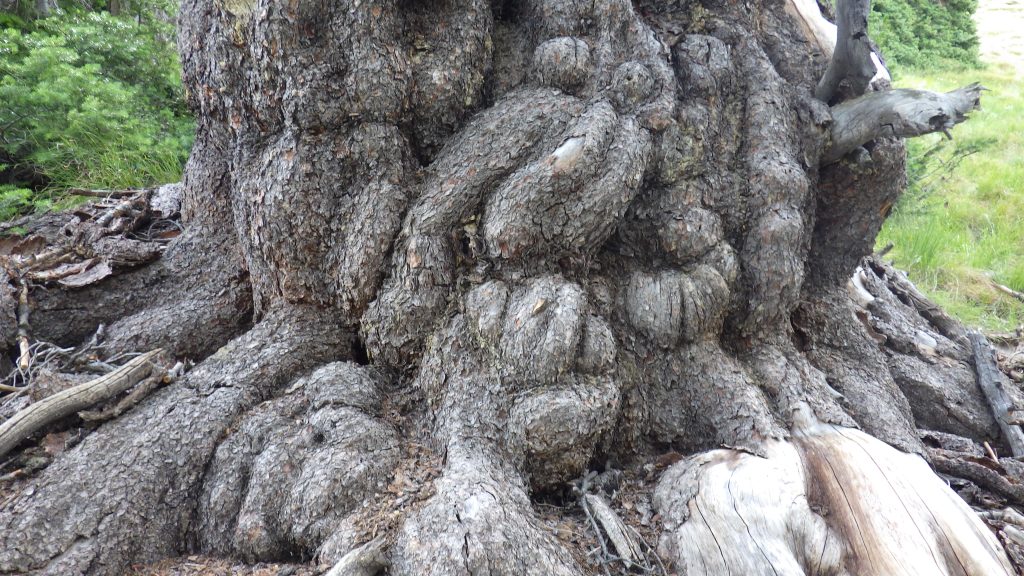
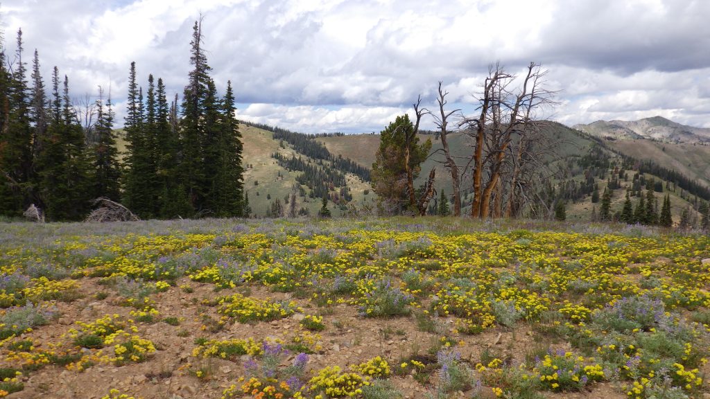
Near the end of the sheep section, I came across a peculiarly shaped tree that I remembered from the last time. It has all these bulbous sections on the trunk, and it makes me think of the enchanted tree from The Last Unicorn because of how it looks. As if it once had been in motion, and been frozen back to stillness.
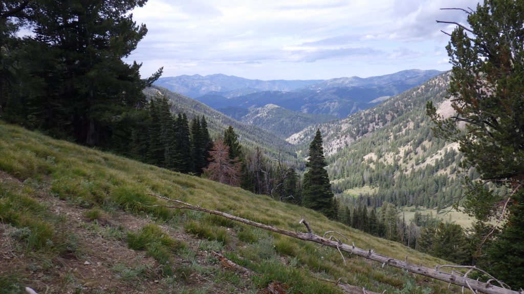
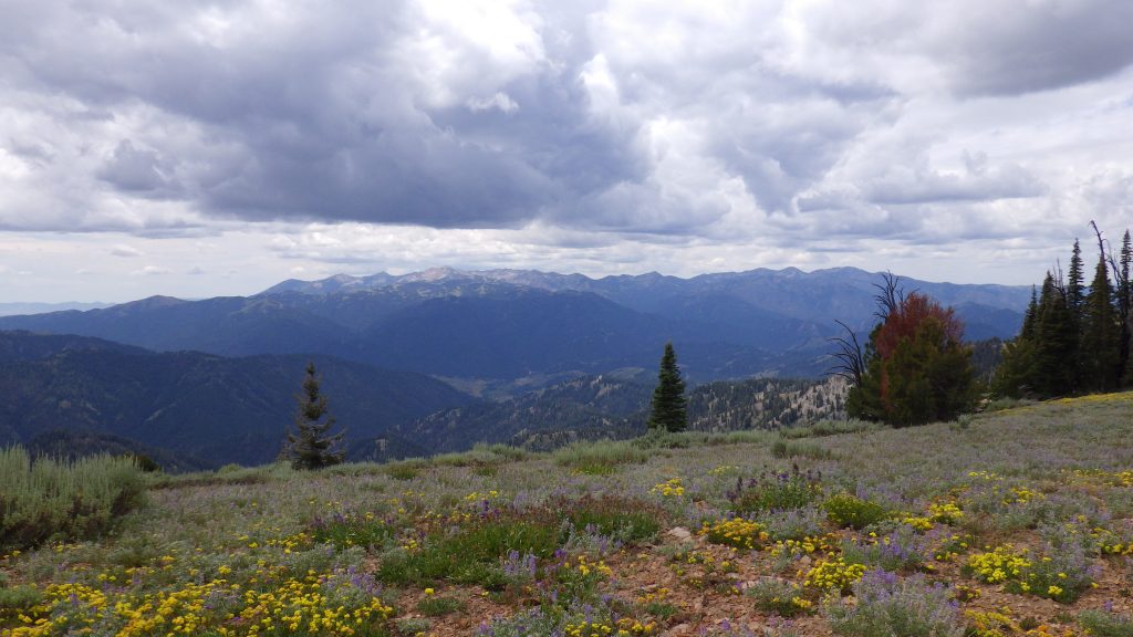
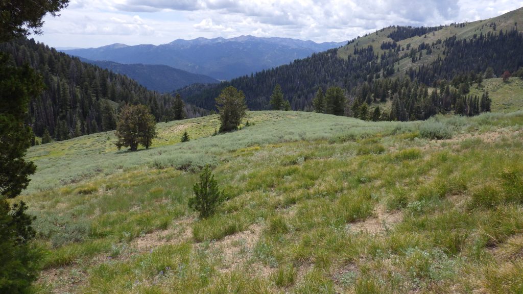
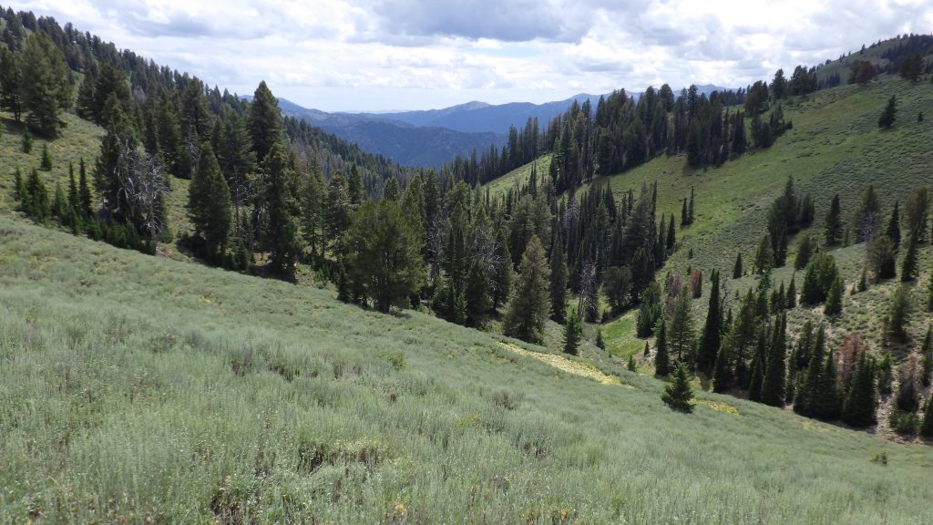
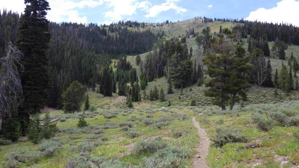
The trail went higher and higher until it topped the ridge. I remembered stopping at this ridge for a break the last time I was here, but the view was much more spectacular today. I could see down the valley to the trail that I’d come up the day before. Well, not the trail itself, but the shape of the valley, all green and brilliant. The trail crossed the ridgeline and I finally began to descend a bit towards my decision point.
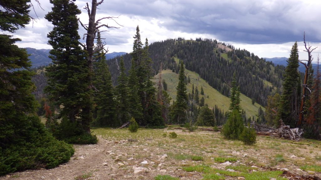
The trail itself did not go up to Skillern Peak, but based on the maps that I’d studied and my GPS, it looked to be about a half mile walk from the where the trail turned up to the peak, with 500 feet of gain. The topographic lines indicated that this approach would be steep, but not so steep that I couldn’t hike it. The question was going to be: did I feel like hiking it? And, to an extent, was the weather cooperating?

The clouds were coming back, though there wasn’t any precipitation. I continued along the ridgeline and came to the descent I remembered where the trail took a sharp right turn down at a saddle, and going straight meant going up Skillern Peak. I thought a lot about Ambrose as I walked. About our life together. All the hiking we had done. And about his death and what happened after.
I considered going down to camp and then coming back up to the peak with less gear, but I know myself. Once I got to camp, I’d be at camp. I wouldn’t be leaving to hike up any peaks. Much better to hike the peak now, and stay at camp when I got there.
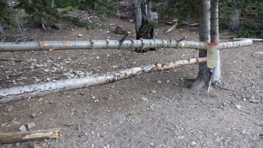
I made my way off trail towards the peak, trying not to lose elevation as I navigated a few saddles on the way. Once the terrain settled into all uphill, I saw a pile of rocks that from a distance did not look to be natural. I headed towards it and found that there was a trail of sorts going up. Perhaps all the way up. I followed from rock pile to rock pile for a while, and then lost it. I found it again a bit higher up where someone had cut a few logs fallen across the trail.


When I was nearly at the peak, my guts started to roil. I found a spot that looked like it had decent dirt to dig in and made a beeline, dropping my pack and getting to business posthaste.
After that, I left my pack and walked up to the peak with just my cameras. The view was incredible. This was the highest peak in the area, and I could see so far with the clear air. The sun even came out a bit to illuminate everything. I found that I could see the road that I’d drive in on, and the junction where I could turn and drive to Featherville. I looked around for a peak register or benchmark, but couldn’t find either. I realized that I’d forgotten to bring Ambrose’s ashes up with me, so I went back down to get them and then back up again.
Scattering Ambrose’s ashes here would spread him all around this area as the wind took them and made them fly. He’s there now, always, a part of that land. The place where he introduced me to backpacking. The place where I came to mourn him.
I ate lunch just below the peak. It was a little after 1, so I didn’t want to wait until I got to camp before eating, even though it was only about a mile away. Eating lunch would help me not make any silly mistakes going back down.
As I made my way back down from the peak, the weather picked up a bit. A few raindrops fell and the wind was gusting. I stopped in a copse of trees to put my raingear on and pee. The best way to prevent rain in circumstances where it’s threatening but not committed is to put on raingear. Plus the poncho helped protect me from the wind.
Once I was kitted out, the rain decided not to fall. And as I looked for the trail, the sun came out and I got a bit hot in my raingear. I couldn’t find where the trail actually was, but I headed down to where I thought it should be and came across it. Then I backtracked so I’d get a good sense of where to go if I should ever make it out there again.
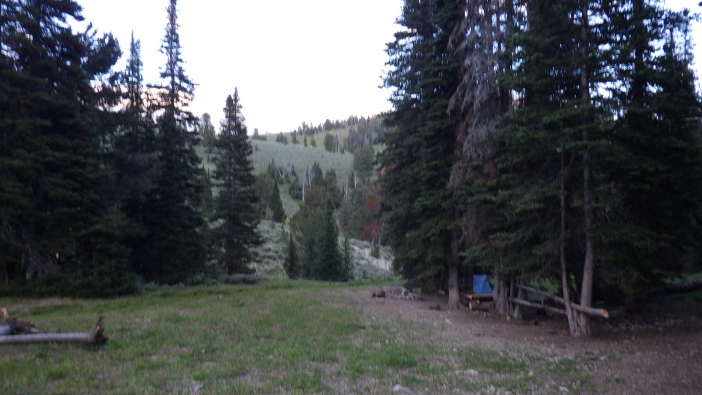
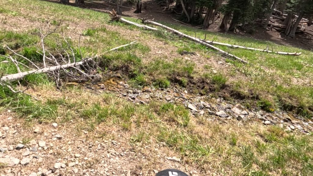
The rest of the way to camp was downhill. The trail was a bit narrow and rocky, but I was able to make a good pace down to the start of Skillern Creek. There was a dry, rocky creek bed that I had to cross, which gave me a moment of worry that I wouldn’t have water at camp. But there was flowing water a few yards beyond that, and across the very small creek, a campsite.
Not quite as I remembered it, but in the same place that I remembered there being a campsite. We ate lunch there all those years ago before heading down Skillern Creek because we were both kind of exhausted and the idea of climbing up several hundred feet the next day was too much. Better to go down and have an easy last day from the Skillern Hot Springs.
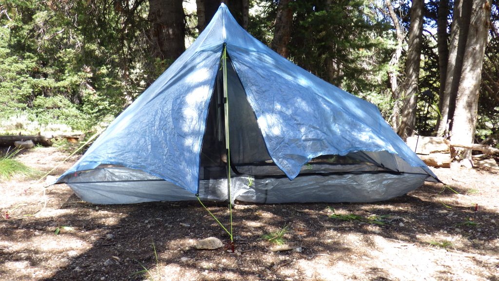
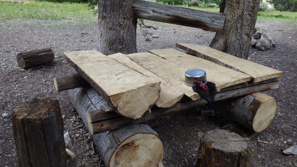
Now, this site featured a rough picnic table along with a fire pit and some freshly mounted logs that surely served some purpose, but I didn’t know what. They were too sappy and rough to put my tent over them to dry.
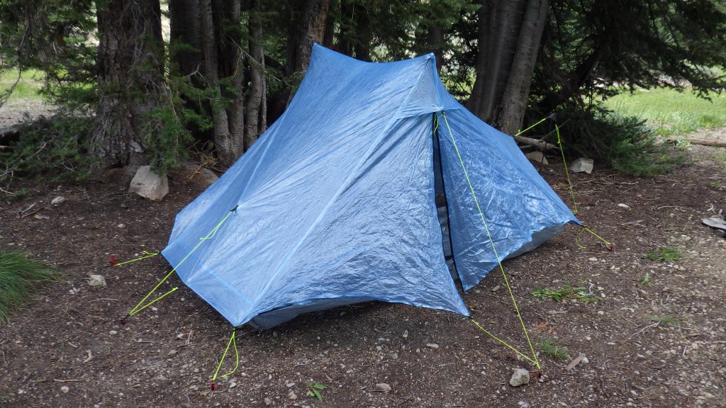
That was my priority when I stopped. The tent needed to dry out, and I needed to get myself situated. There was water to filter and a campsite to explore and I had a whole afternoon to spend relaxing with my Kindle. I ended up hanging the tent from a nail that was affixed to one of the trees by the picnic table. It sort of worked. After I took a break, I ended up just pitching it to let it finish drying. It really does dry quite well when it’s pitched and empty.
I explored the trail, confirming that it did start to switchback up not far from the campsite. I found a good place to get water. I didn’t need to use my pot to fill my bag, there was a little ledge that let the water fall right in. I spent most of the afternoon reading in dappled sunlight.
The table was very convenient to use for making and eating dinner. But there was a fair amount of trash around the site. A Saltines wrapper not far from my sitting spot, dried out lime wedges, bits of paper. I put the Saltines wrapper in my trash to pack out, and put the limes and bits into the firepit. It irks me that people who come in on horses can’t even pack out their own trash.
After dinner, I moved into the tent. After the sun sank below the ridge, but before it really set, I came out to pee before sleep. There were deer upstream near the creek. I startled them. Most of them moved off before I could snap a picture. I considered the sight another gift from Ambrose on our anniversary.