When Ambrose and I drove out a few weeks ago along the Middlefork Road, we spotted a trail that seemed to go straight up from the road. We agreed that it would be our training hike to start the season, and when we got back from that trip, I tried to find the trail. The only clue I had was that it was near Irish Creek. We both looked over Google maps to trace the trail pretty far back, and neither of us really knew where it went, though Ambrose noticed a peak it might approach.
This last weekend we made good on our plans, left the house around 5:30 and arrived at the trail before 7 in the morning. As we started hiking up, the sun hadn’t yet risen above the high surrounding ridges, though it was bright enough that we had no need of headlamps. I was wearing my new Softstar Switchbacks for the first time on a hike, and it would prove to be a trial by fire, er, elevation.
The trail that looked so steep from the road? Yeah, it was even steeper than I thought it would be. While it did start off relatively nicely, it soon became a series of hill climbs. They were practically staircases (Ambrose later calculated the average grade of the hike at 19%!). I found myself trying different gaits just to deal with the steepness. Whoever designed this trail clearly had something against switchbacks.
Ambrose spotted some deer high overhead. I wished for their fleetness of foot as I trudged up the steep, switchbackless trail. I know I complain about switchbacks sometimes, but there’s a balance to be found between super long switchbacks and none.
I sometimes just used my forefoot, and other times I did a sideways crossover step. The crossover step felt a lot better than going straight up, but I didn’t have a lot of stamina doing that. I’ll probably build that up as we continue to hike this trail (of course we’re going back, it was HARD). I called a break less than a mile in, because I was not prepared for this much uphill. The boots were doing okay. I was noticing the lack of gusseting on the tongue, because little rocks kept sneaking inside and poking my toes. It wasn’t awful, but I did take them off to get rocks out and retied them at the break.
The retie helped keep rocks out, but next time I take these boots up this trail I’m going to wear gaiters and see if that improves the experience. We took another break for a call of nature, and then made our final push to what looked like the high point of the ridgeline. I was so happy to get there, where the trail transitioned from motorbike eaten dirt piles to grassy walking trail. And I didn’t see any uphill in the direction I was facing.
Alas, the trail took a right angle turn and led me to gape at yet another steep stretch of trail ahead. Okay, I said to myself. This trail is just going to keep climbing. No matter what I hope or want, it’s going up, and I’m going along for the ride. I did, however, call for a break before we started the next big uphill.
The trail did indeed keep climbing. Up, and up, and up. Always turning and weaving to find the absolute highest points along the ridge to follow. The higher we got, the more we could see across the reservoir. Grassy plateaus and low meadows shone green under the white, snowy peaks that I’d never seen from the road. We came across patches of snow hiding in a gully, but none on the trail.
I finally saw what looked like a genuine top-out. And when I reached it, it was a top-out! The trail continued on down, and then climbed right back up again! How dare it? I was dismayed at the prospect of losing so much elevation only to go up again. My body said, no, not today. And I agreed.
When Ambrose caught up with me, I showed him the GPS; we had gone nearly 2 miles and up about 2100 feet. I also asked how he would feel about turning back. I was so glad when he had no issues about it at all, agreeing to my tentative suggestion readily. Probably because he would get to show off his downhill hiking skills, which are superior to mine.
We were just starting to get going when a guy hiked up the trail. He asked if we’d made it to the peak, and we said no. He hiked on. The peak? Hmm…
Next time I start an intense downhill like this in the Switchback boots, I’m going to make sure to tighten and retie before starting. But I’m not sure that would have been all that much help, because of the angles that the trail forced my feet to take. It wasn’t long before I needed to take a break to dump little rocks and retie the boots, and as I was finishing up voices floating up from below became a pair of women, accompanied by a teeny, tiny dog.
They, too, asked about the peak. As did the next group, and the next, and the next. We just kept running into people as we went down, and I finally asked one pair, “What peak is it that everyone keeps talking about?”
I think she was surprised that someone would be hiking a trail without knowing where it went, and she replied, “Heinen.” Pronounced Hay-nen. I resolved to look it up when I got home.
When we got back down to the motorbike widened section, the trail was wide enough that I could kind of trot beside Ambrose and figure out how he was moving faster by mimicking him. But I didn’t do that for too long, because the trail was too rocky to be side by side. I took the “switchlets” aka not really switchbacks, but little curves around the parts of the trail that resembled a rockslide.
The Switchback boots were not doing great on the steep downhills. My toes were sliding down into the front of the boot a bit, and the big toes were both getting a bit sore from it. I was regretting making this my first hike with these boots, because I think they’d do fine on a normal trail.
I was trying to keep my legs and body more relaxed than I usually am on a steep downhill hike. I get nervous about falling, and I tense up and it makes the hike much harder on me than it needs to be. I managed to avoid making my muscles go into tremble mode by focusing on that. Definitely need to remember to relax on those downhills!
One group, near the bottom, asked if we’d seen the sunrise on the trail. The question gave me pause, because I had just spent a couple hours exerting myself and now I was being asked a weird question, to me. Seen it? Well, not technically. I wasn’t watching the sunrise. But I was here when the sun rose, so I said that. I could have said yes, but my answer to his actual question wasn’t yes, because I didn’t “see” the sun rise. I may be too pedantic at times. . .
Ambrose and I passed one more pair of hikers just leaving the road, and then we had to carefully avoid a few vehicles on the short road walk to the car. At this point, we were both feeling our leg muscles protesting the use we had just put them to. I took advantage of the pit toilet, and then Ambrose drove us home, grateful that we no longer drove a manual.
Once we got home, I figured out that the Mount Heinen trail is a total of 5 miles out, approximately 3200 feet of gain. The drop we had been facing was “only” 150 feet down before the climbing resumed, which meant we would have had roughly 1250 feet more uphill before we hit the peak. Both of us were pleased to have done over 2000 feet for the first trip. And I’m not alone in being eager to go back and try myself against that tough trail. I need to get in shape for the Idaho Centennial Trail in August, and I believe the Mount Heinen trail is just what I’m looking for.
 |
| Two celestial bodies in the dawn light, but I’m not sure which ones. |
 |
| Yes, the trail is steep. |
 |
| The trail also rolls past a memorial. |
 |
| Blurry deer. |
 |
| Ambrose’s new day pack looking good. |
 |
| Ambrose making his way up. |
 |
| Oh, yes, it keeps climbing. |
 |
| More uphill, and we’re getting higher. |
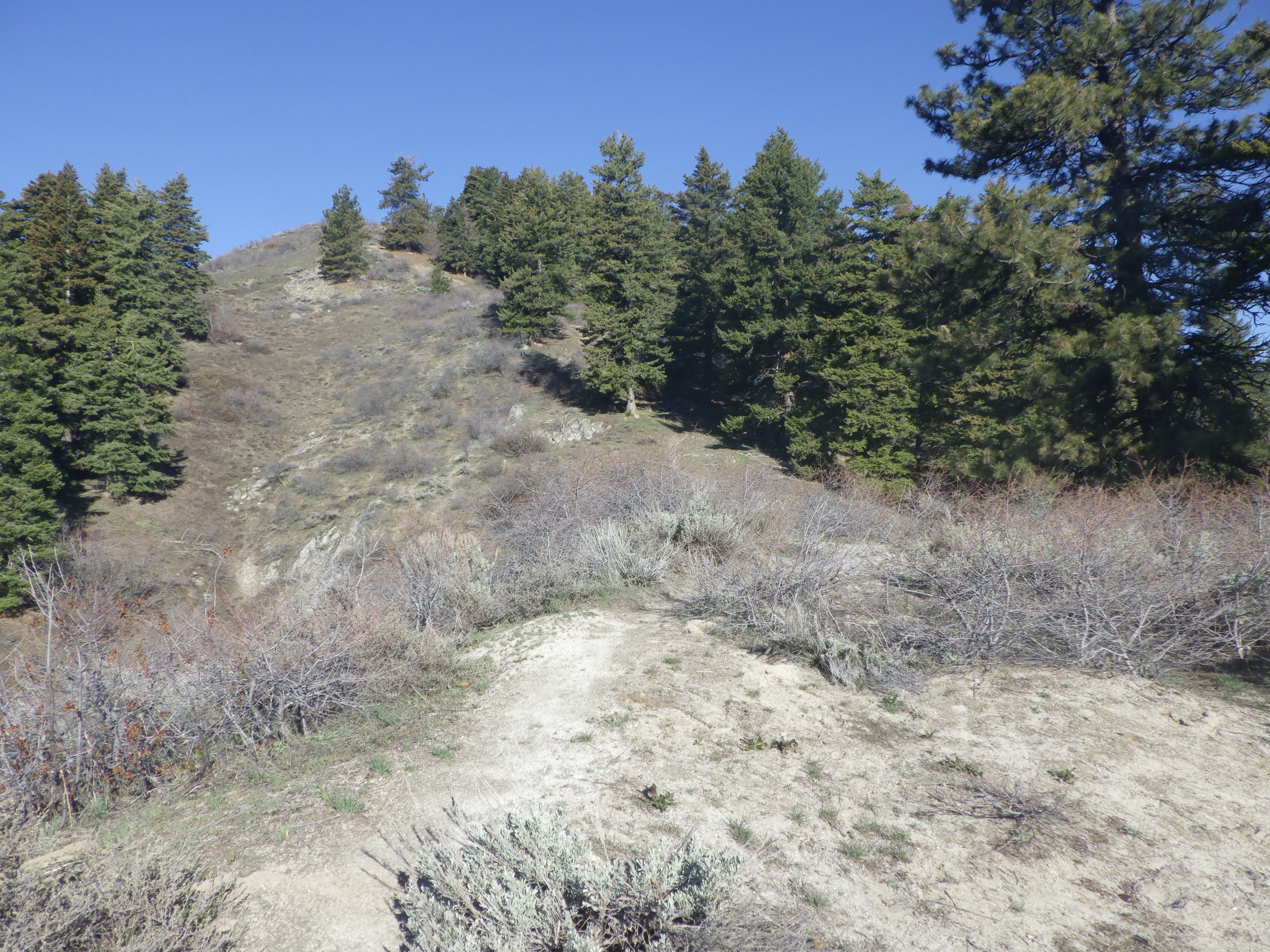 |
| I say to myself, does the trail really go all the way up there? And I answer, yes. Yes, it does. Keep climbing. |
 |
| Yay snow! |
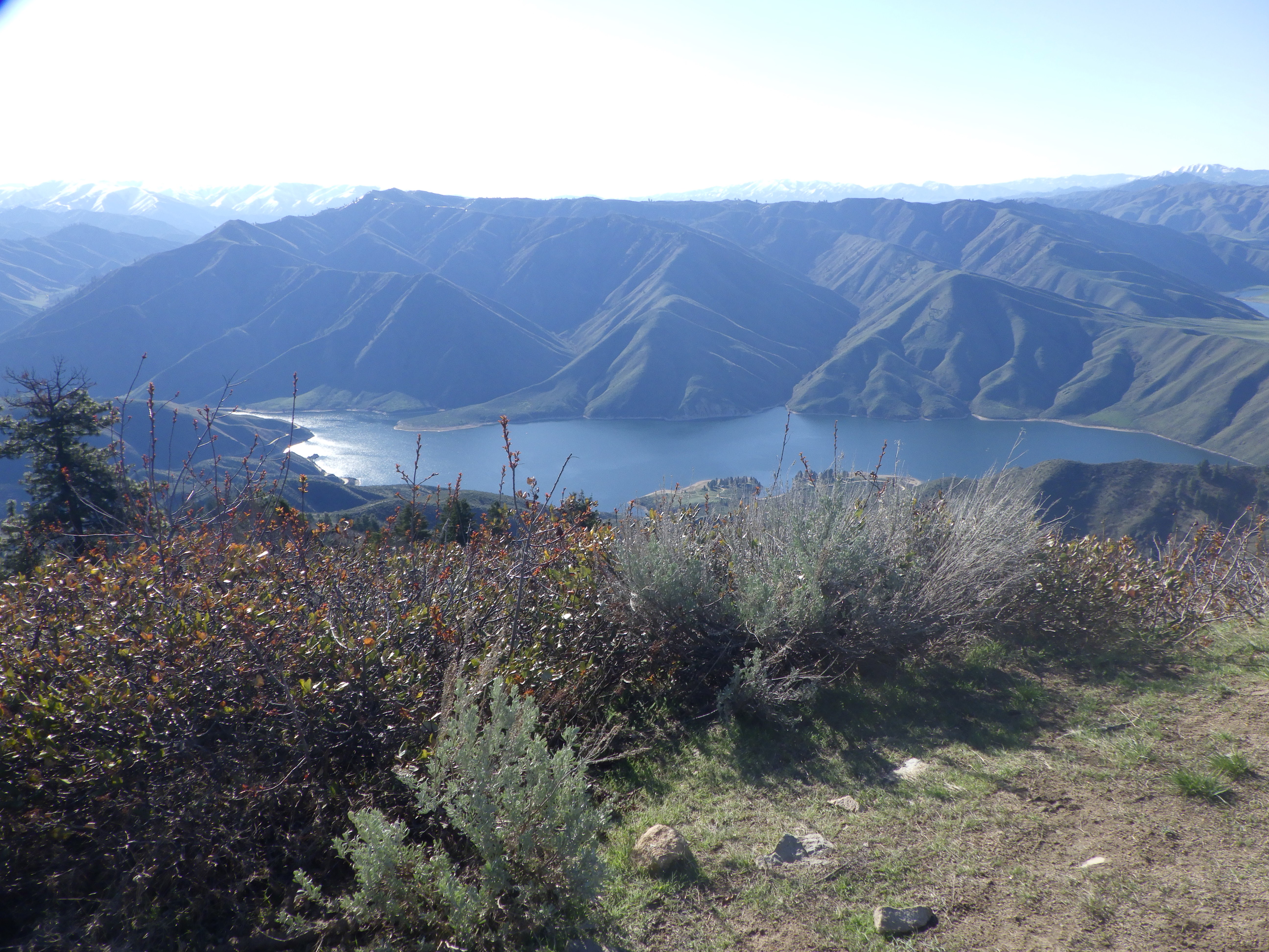 |
| View from our top-out spot. |
 |
| View of our top-out spot. |
 |
| Looks like we can see all the way to 20 from here. |
 |
| The views coming down were rewarding. |
 |
| I don’t normally like downhill, but this one was a relief. |