The alarm, of course, went off at 5:30, but Ambrose decided we could sleep in a little bit. Not a full hour, but just another 10 minutes or so. It was once again warm this morning, so we didn’t need to put on our down jackets to start hiking. I mean, I could have. It wasn’t super warm, just not super cold.
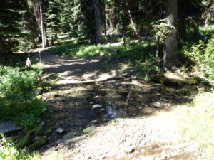
I wasn’t entirely sure that the trail continued beyond where the road crossed the water, but Ambrose was. He’d checked it out the day before on one of his water fetching trips. While I initially found that water spot, I only confirmed water because I didn’t want Ambrose to have to walk back down to where we crossed Coin Creek.
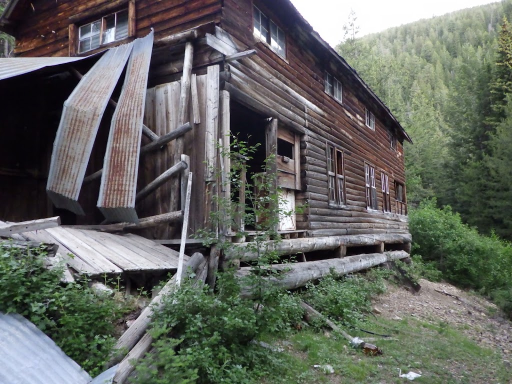
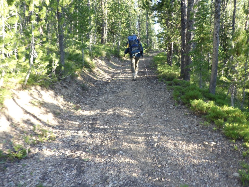
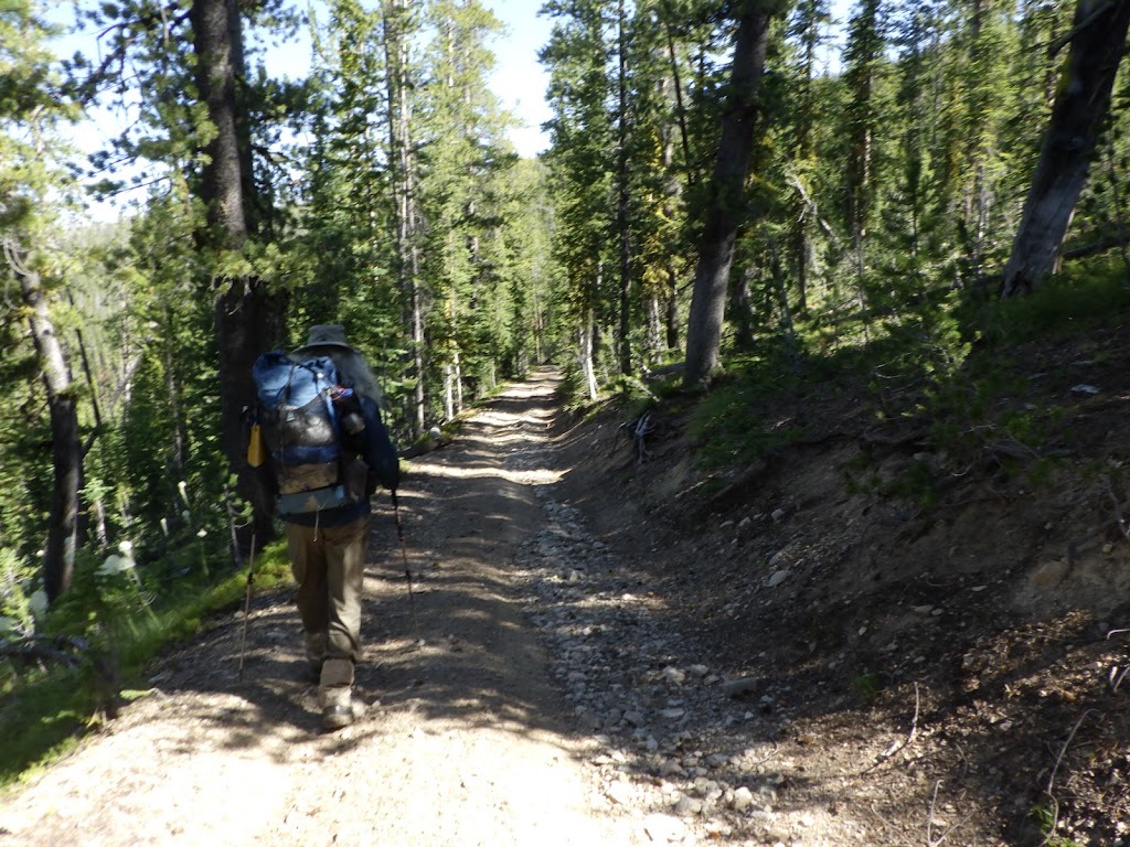
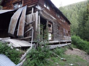
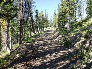
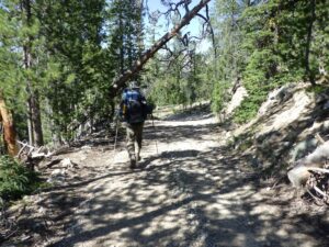
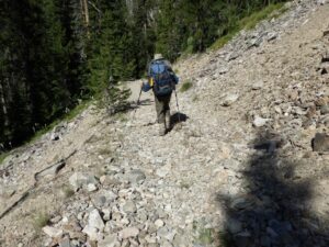
I expected the trail to be in pretty good shape, considering it was technically a road. And it was. We saw a few more structures as we hiked out, including one building that appeared to have a driveway, though it was blocked off by logs.
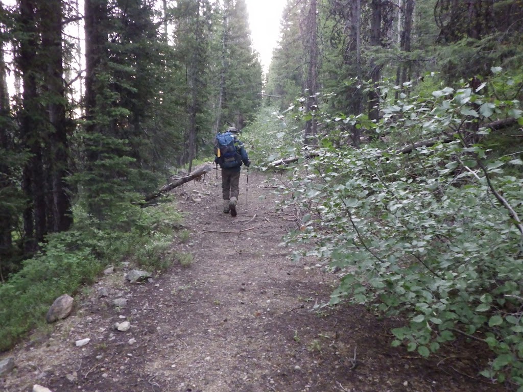
There was not a lot of deadfall on the old road, but it was clear that vehicles were no longer coming back here. Plants were beginning to encroach on the road, at times narrowing the clear path to the width of a trail.
Ambrose and I have heard that folks want to re-open the Golden Hand Mine. I’m not sure how they’d possibly manage to get vehicles back there. And if they had to use mules to haul rock out of the wilderness, a lot of work would need to be done first.
We had about 1800 feet of elevation to gain before we hit our high point, and, based on past experience, I thought we’d be resting more.
Nope.
Ambrose was like a machine. He just kept walking up the road, no stopping until break. None of those semi-breaks where he would stop forward movement for a breather, to wipe his face or take a drink. He just kept going forward. I’ve never been so simultaneously proud and annoyed.
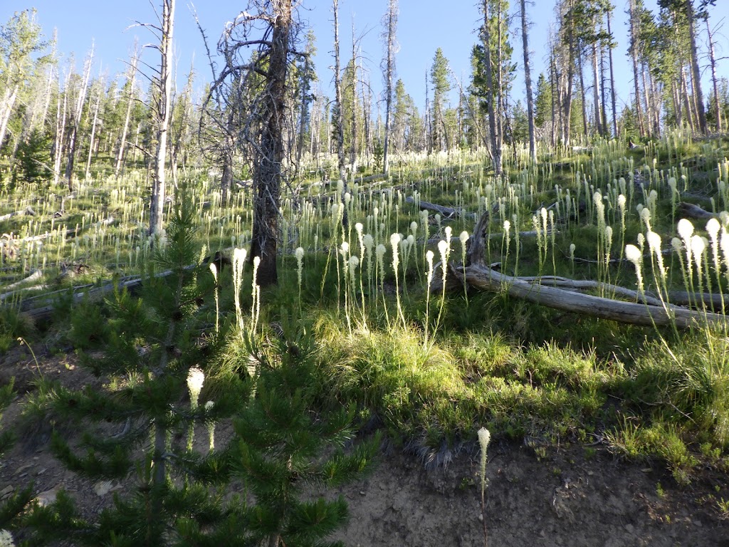
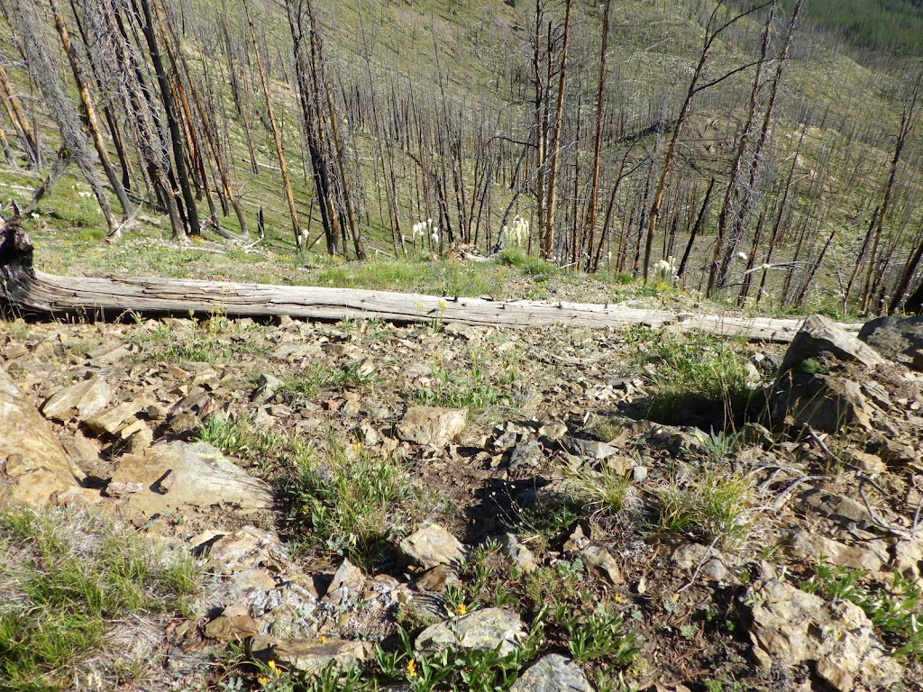
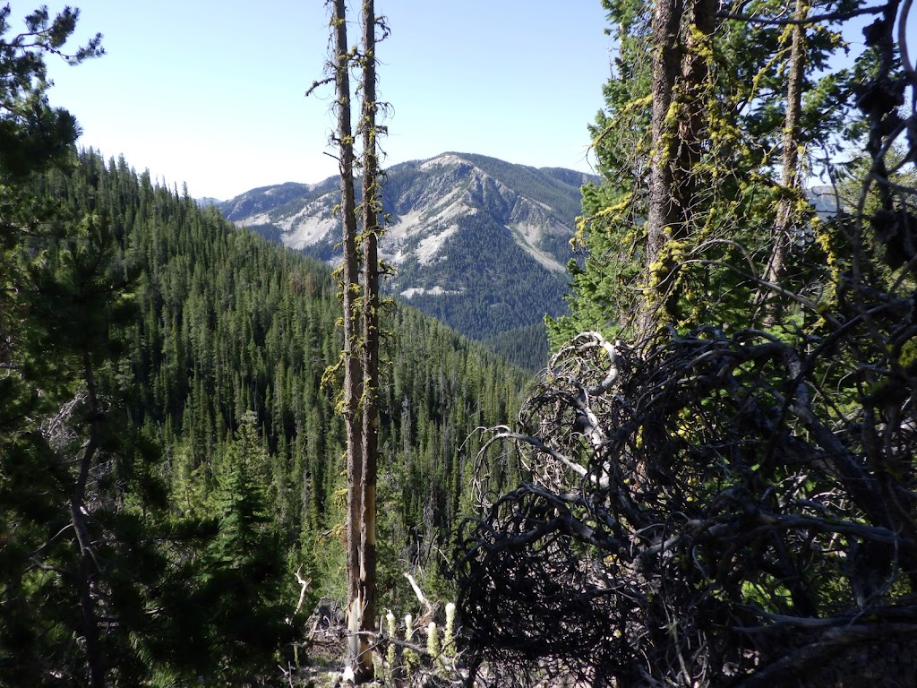
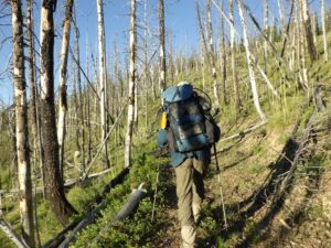
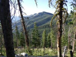
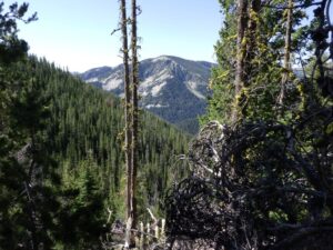
This area had burned a bit some years back. While we started out in green forest, the road brought us to a more desolate view. I think desolate might be the wrong word here; while there were many dead trees still standing, stretching out in my view farther than I could clearly discern, there was also life. Shrubs and flowers and bear grass. Young evergreens and mosses and mushrooms. And if the trees weren’t dead, I wouldn’t get such an expansive view.
The road also had some twists and turns that brought us back and forth between burned and non-burned areas. It switchbacked a few times. Even though my feet were aching, I was also planning on how to get Ambrose to come with me to the top of Pueblo. I figured he’d be easier to persuade for this side trip because it was a shorter climb. And we hadn’t been hiking for very long yet.
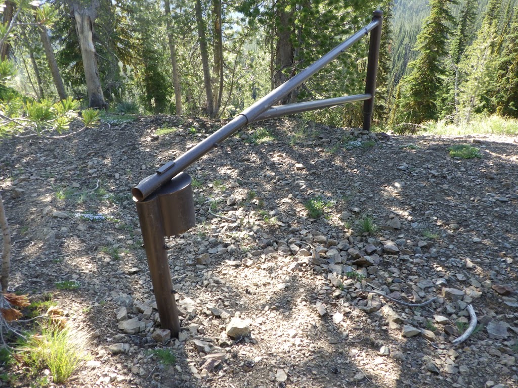
In fact, we only took one break on that part of the road. We had already reached Pueblo Summit when it was time for the second break. Pueblo Summit is the highest point where the road goes. We knew we were getting close, because there was a big metal gate across the road. That’s to keep cars and ATVs from (mostly ATVs up here) from driving into the wilderness area. After the gate, there was also a sign. We dropped packs and I went off to find a place to dig a hole.
I found a pretty nice campsite up there. People clearly do come up and use the area. There was a lot of cut wood, including chunks just spread out in the grass for seemingly no reason. I found a place to dig and enjoyed my bathroom view. Then I went back to make sure Ambrose would accompany me up to the peak.
To his credit, he didn’t take much persuasion. I think the whole experience of going up to the Sheepeater Lookout when he was exhausted really shifted his perspective. Plus, after we left Pueblo Summit, we only had a couple of miles to hike and it would literally all be downhill (and I don’t use the word “literally” lightly).
We didn’t know if there was a formal trail up to the peak or not, but there was a side road that started off in the right direction. I led the way along it, but before too long Ambrose warned me that we were going downhill and were about to walk past our perpendicular to the peak. I was fine with turning off the road, so I did just that. Then I let Ambrose take the lead, because he had the GPS in his hands. I wanted to climb a peak, not get lost!
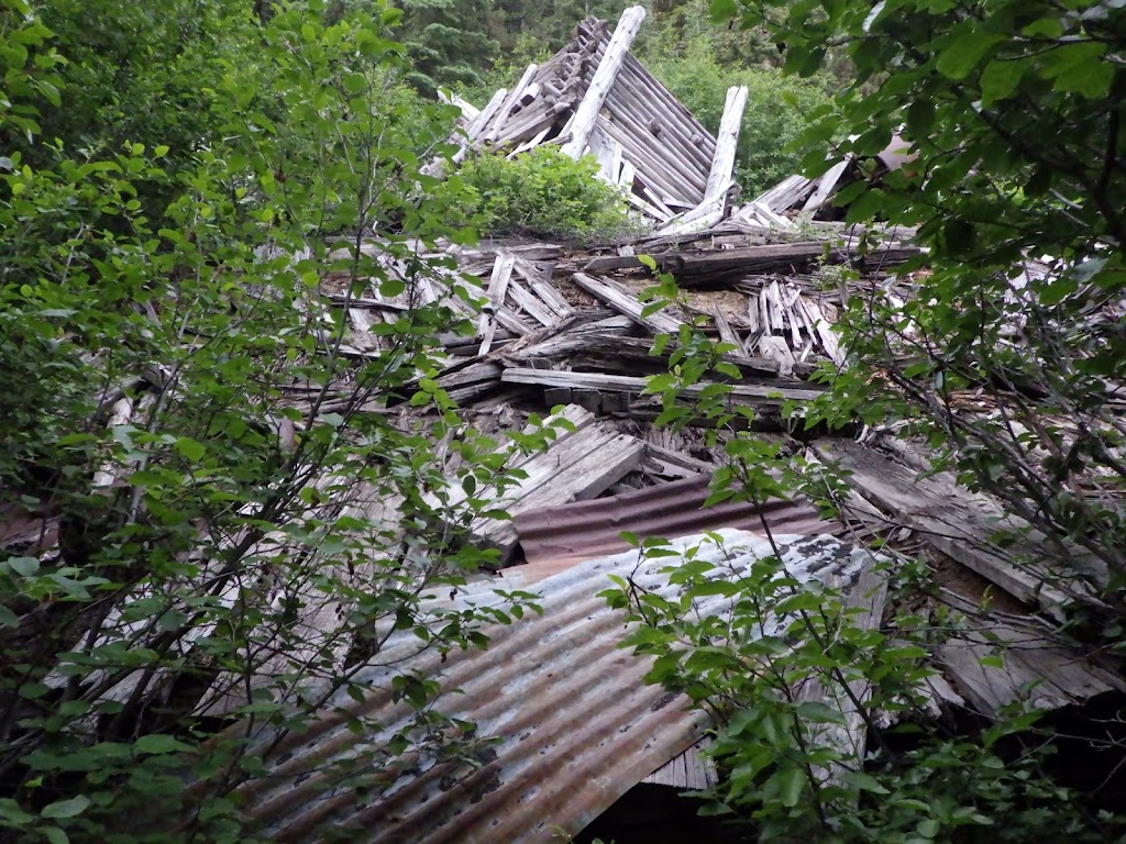
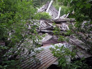
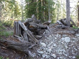
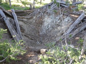
We only had about 300 feet of elevation to ascend, but in less than half a mile, that’s a pretty steep hike. Still, Ambrose kept up his pace, pausing only to find the best routes and make sure we were still on the right heading. So here we are, not on any trail, taking a weird route up to the peak, and all of the sudden we see the remains of structures. Small structures, but clear evidence of the hand of man. It may have been an old mine entrance, or just a collapsed cabin. It was kind of hard to tell at this point. Though the collection of boards in a pit seemed to lean toward mine.
That turned out to be about the halfway point. After a bit more hiking through gently wooded terrain, with mostly grass underfoot, I spotted the peak! I knew it was the peak because I could see the benchmark sticking out of the ground, highlighted against the background of the sky. I quickened my steps, while Ambrose continued at his steady pace. He couldn’t see the benchmark, but there was no mistaking the view once we reached the top.
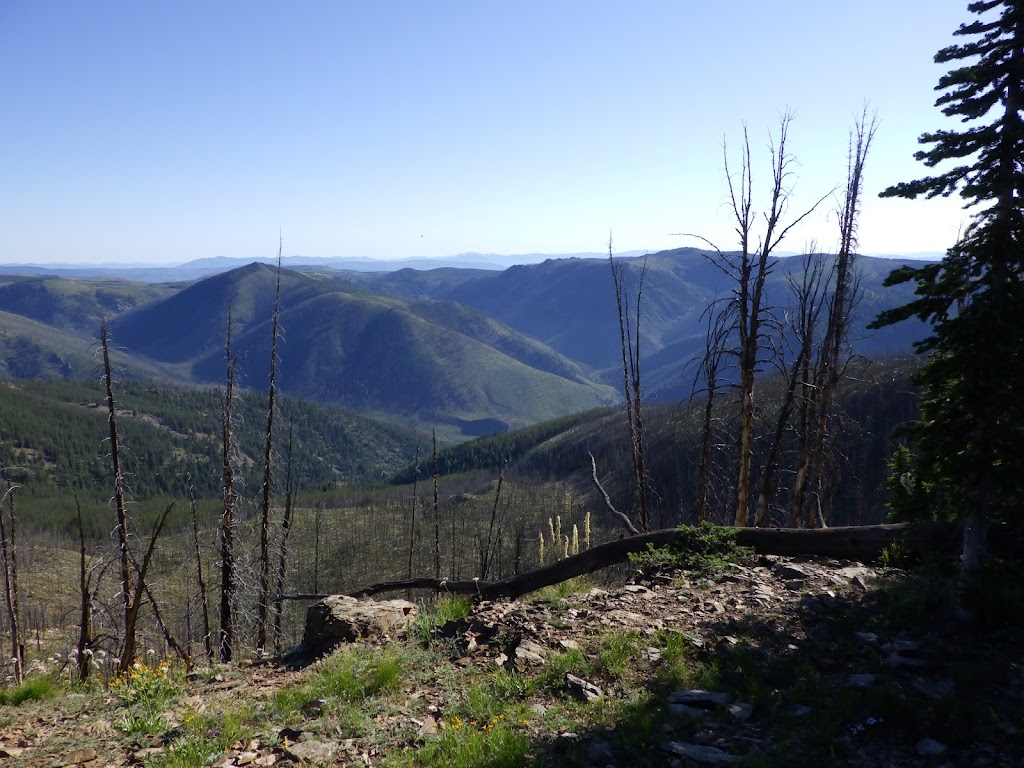
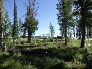
This peak is not in the wilderness. It is just outside the boundary. The approach to Pueblo is relatively gentle, wooded, and grassy. This ends at the peak in a sheer drop-off that provides the most incredible panoramic view of the wilderness. As if it were built specifically to showcase the spread of wild lands it overlooks.
My heart filled at the sight. My heart fills just to remember it.
Ambrose sat on a convenient, couch-like log and messaged his family in between gazing around. I stood near the edge and drank in the scenery. I could see where we had hiked the day before, through the old Hand Camp that is now a tangle of fallen trees. I could see for what felt like miles and miles and I could have stayed there a long time.
But we had left our packs down by the trailhead, so we couldn’t linger too long. Critters would be getting bolder about exploring our gear every moment we were away. Rather than retracing our steps, we took the most direct route back down to our packs. Ambrose continued to lead the way, consulting the GPS from time to time as he judged which path would be easiest to take.
I think the hardest part of the descent was walking on the slippery grass. It was tall enough to create a slick layer between my boots and the ground. But only if I stepped on it. I was mostly able to avoid the grass, but sometimes it was unavoidable. Before too long, we made it back to our packs. The first clue we were getting close was the collection of logs cut into small chunks buried in the grass. I’m still not sure why there were so many pieces of wood lying about, but someone must have been doing it.
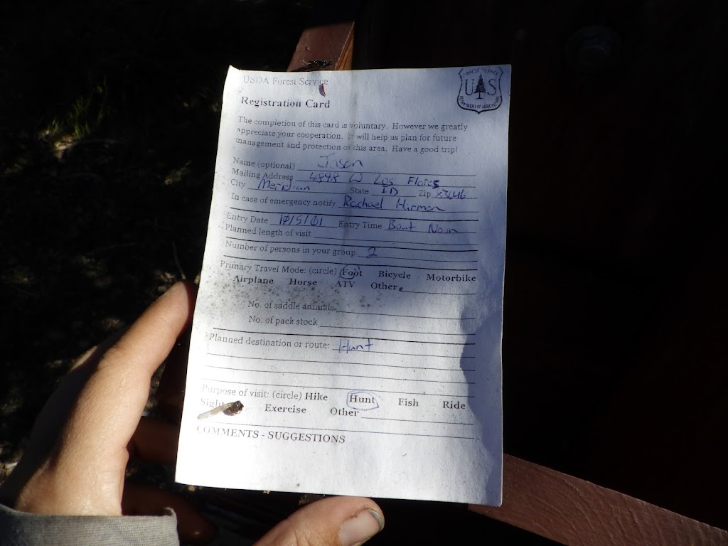
There was a permit box at the trailhead, and I took a look inside. One blank permit was inside, and one filled out. I took a look, figuring it would be pretty recently dated. Nope. Not even close to recent.
2001.
Yeah, it was probably a misprint. That’s what the ranger said when I showed it to him later. But it was still funny to see such an old date out there. I was already giggling about teasing the ranger about not having checked this box in over two decades. I took a picture, but left the permit.
Ambrose’s hair was blowing in his face. It had, in fact, been blowing in his face for a while. Because his buff had fallen off – the second one that the Frank has claimed from him. We weren’t sure when it had fallen off, but Ambrose wasn’t interested in looking for it. I kind of wanted to; I checked the camera to see if I could determine when it had fallen off, but all I got was that it was sometime between just before we left the wilderness and when we noticed it missing. It could have been anywhere up Pueblo, though now I wished I’d gone back down our trail in the wilderness. It might have been lying on the ground just around the next bend…
Then we headed down the road. It wasn’t even lunch time yet, and we were getting pretty close to our destination. Our plan was to spend the last night at the same place where we spent the first: the Jeep Camp. That would leave us very close to the car for the hike out the next day, but also allow us to spend one last night out in the woods. Not the wilderness, since we’d just left that behind, but the woods where few venture.
There were clearly tire tracks on some sections of the road, but we neither heard nor saw any motors. The road sloped down at a pretty steep grade, leading us on a rough, rocky, descent. Still, there was never a question of losing the road, so it was pretty easy. Especially compared to the prior day’s “trail.” I liked the views that I was able to glimpse through the trees, and there was one switchback that offered a particularly breathtaking vista. But I didn’t linger too long. Ambrose was on a mission to get to the camp.
His pace still hadn’t slowed. He was hiking steadily, and faster than me. But I wasn’t too surprised by that; he’s always been fast on the downhill, and I have to be in rare form to keep up when he’s in his rhythm. As we got closer to the Jeep Camp, I started looking around on either side of the road, wondering if there might be an even better campsite somewhere up here. We crossed a stream that flowed over the road, and then it was just one more turn until the trailhead was just visible ahead. Ambrose and I took pictures of each other at that point, that we’d just finished our loop.
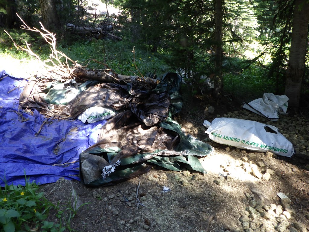
Then I turned off to explore an area north of the trailhead, while Ambrose went to confirm Jeep Camp was available. I found what could work, maybe, as a campsite, but it seemed like mostly a good place for stock. There were even piles of bags that looked like some kind of feed. While they may have been allowed to store things there, I rather doubted that the Forest Service would be happy to learn that some of the bags were uncovered and torn open. In the end, the ground there was too damp and lumpy to consider. Ambrose came up to see what I’d found, but we agreed to camp at Jeep Camp again. It’s just the best spot up there, though it’s good to know there are alternatives in the unlikely even that someone else was occupying Jeep Camp some time.
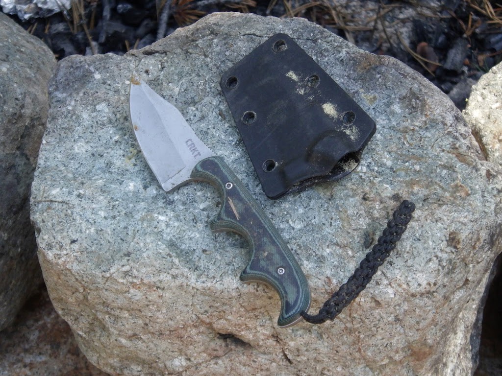
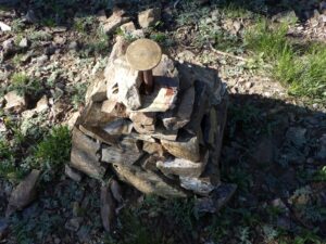
As we walked on the rocky road over to Jeep Camp, I was looking at the rocks. I was still marveling at the way my new boots let my feet conform to the road surface, giving me so much more stability despite the road surface. And then I spotted something on the road was that not a rock or a stick. Not dirt, not water, no this was a manmade object. I bent down and picked it up. It was a tiny knife in a plastic sheath. I picked it up and brought it to camp, where I proceeded to give it to Ambrose.
Then we settled in at Jeep Camp. I wanted to eat lunch before taking care of the tent. I watched with hungry eyes as Ambrose poured our fancy sushi-grade tuna pack into the freeze dried, rice based meal. And I almost told him not to do it, because I know that sometimes mixing things in with the freeze dried meals can interfere with their reconstitution. But I figured he knew what he was doing, and said nothing, gratefully accepting the empty tuna packet so that I could scrape up any remaining scraps into my mouth.
Fifteen minutes later, it was clear a mistake had been made. While Ambrose’s Pad Thai from the night before had not suffered from having the tuna added first, the coconut oil that the tuna was packed in proved less friendly to the rice. Pretty much, the rice absorbed no water. It remained crunchy, and there was a ton of water in the bag. Leaving it longer did not help. The rice had absorbed oil and had no more interest in absorbing water.
And yet.
We were so hungry, we ate it all anyway. I regretted it not too long after as my stomach started to protest the rice nodules I’d subjected it to. That one hurt for quite a while. Next time, I am NOT keeping my mouth shut on that advice. Still, the food was filling. I mean, it was actually delicious, and I look forward to eating it again some time, with the rice fully reconstituted. Maybe we’ll add the tuna, but only AFTER the rice is done rehydrating.
After that, I got the tent set up. Then there was nothing left to do but appreciate the beauty of the woods in the time we had left. Ambrose, in his explorations, had found that a tree was down across the road just south of the Jeep Camp. If anyone actually came up this direction, we’d hear them sawing through the log well before they came into view. Though, in truth, absolutely no one drove up. We had the afternoon to ourselves, to talk, and to listen, both to each other and to the woods around us. It is commonly accepted that only humans have sentience, though some may also extend that to animals. I believe that we cannot rule out the possibility of another kind of sentience or consciousness existing in plants, and even rocks. And I believe being in the woods does something for me that even a walk in a beautiful park in the city simply cannot.
We could have planned on sleeping in the next morning, but we had a different plan. To wit, get up at the regular time and hustle our butts down to the car so we could drive to Big Creek and have breakfast at the lodge.
 |
| Well, I caught a great smile from Ambrose, but my own face went kind of funky. |
 |
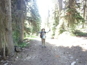
| Bye bye! |
 |
| The old mine entrance, now collapsed for safety. |
 |
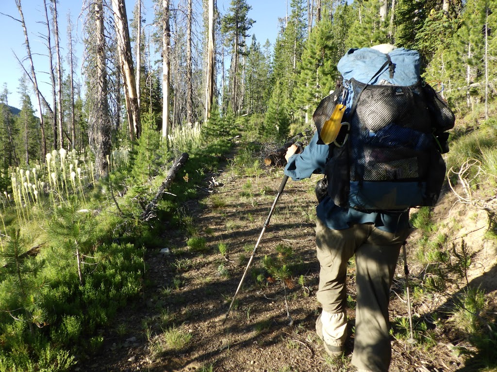
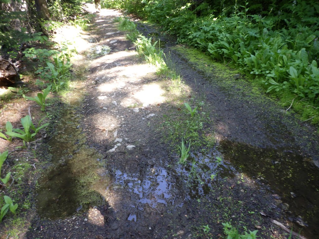
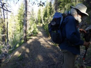
| Ambrose navigating our first stream crossing of the morning. Oh, this IS the road, by the way. |
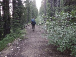 |
| The start of the hike was on unmaintained road. |
 |
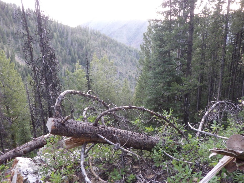
| One last glimpse down to where we hiked up the day before. |
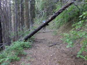 |
| We came across several downed trees, but most were like this, easily navigable. |
 |
| Ambrose kept pulling ahead when I stopped for photos! |
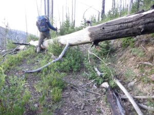 |
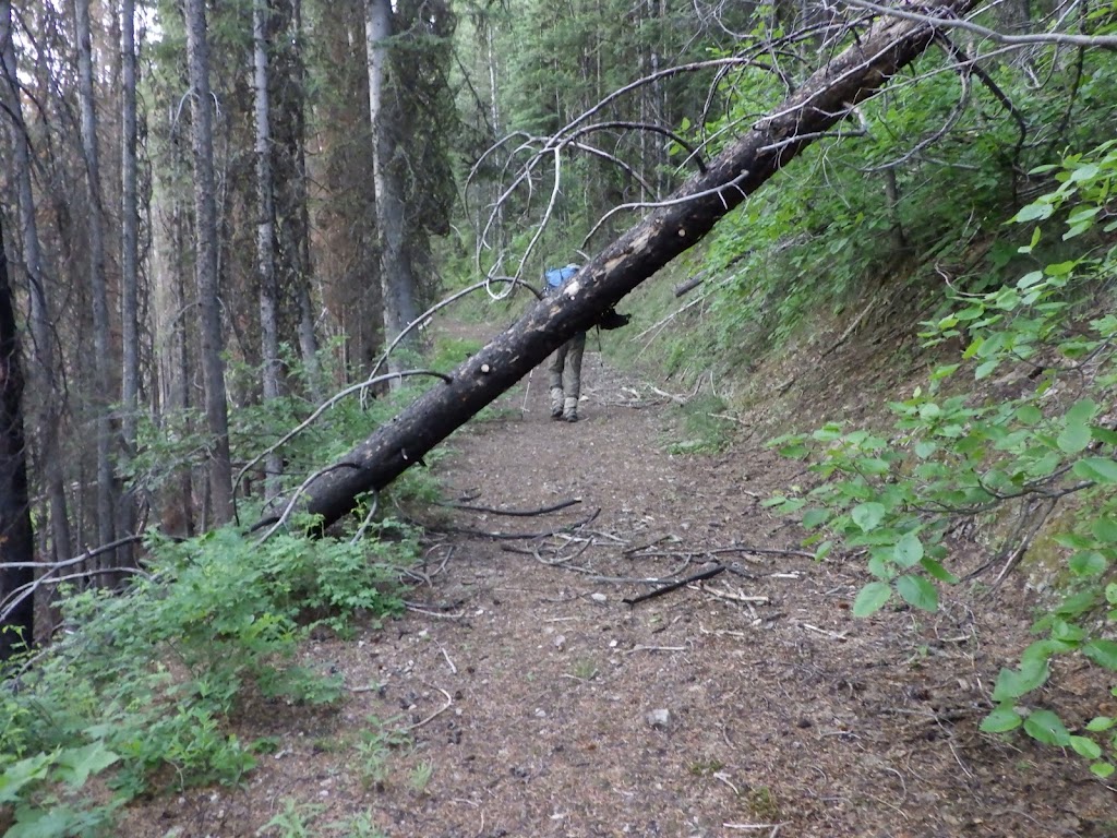
| This may have been the hardest tree problem of the morning. |
 |
| Finally, caught the sun. |
 |
| We took our break somewhere around here, sitting in the sun at the side of the road. |
 |
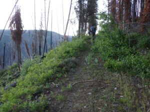
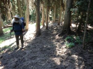
| Some sections of road were more clear than others. |
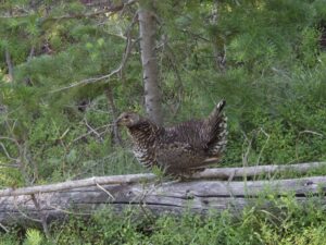 |
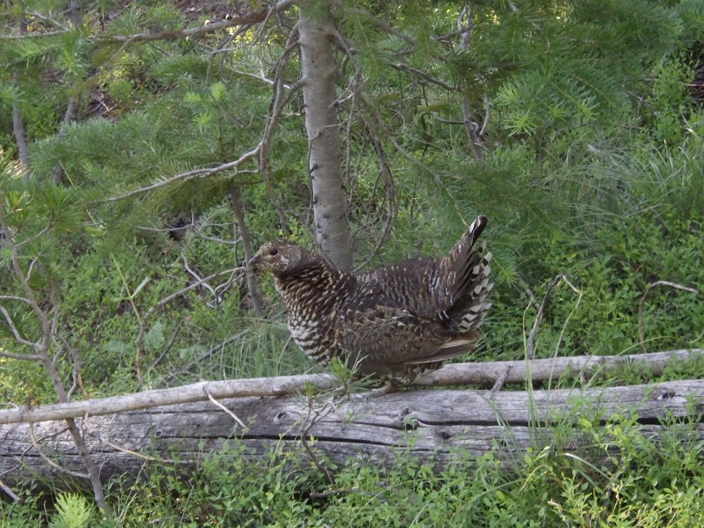
| This grouse obligingly posed for me. |
 |
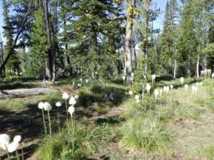
| More bear grass in bloom. |
 |
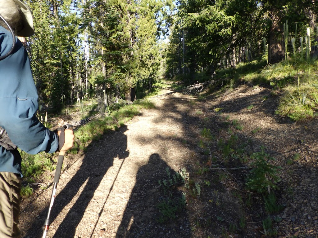
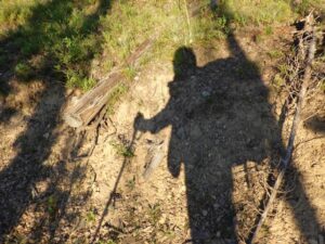
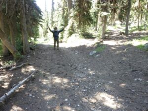
| I got our shadows together! |
 |
| Oh yeah, there were some pretty sweet views as we hiked. |
 |
| And a lot of bear grass in bloom. |
 |
| Ambrose hadn’t lost his buff yet here. |
 |
| Oh, that’s a gate! |
 |
| A gate close-up. |
 |
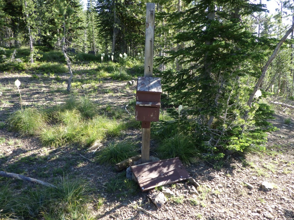
| The permit box at Pueblo Summit Trailhead. |
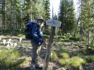 |
| Ambrose at Pueblo Summit Trailhead. |
 |
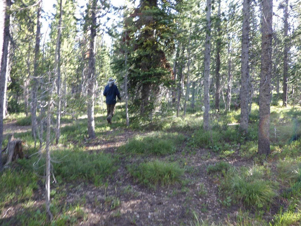
| Ambrose route-finding our way up to Pueblo. |
 |
| How we managed to find this… |
 |
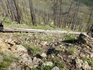
| It was definitely a structure at some point. |
 |
| From here, I could just see the benchmark. |
 |
| This picture does not come close to capturing the majesty of this view. |
 |
| The benchmark! |
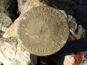 |
| Benchmark close-up. |
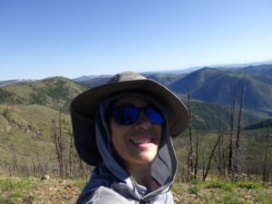 |
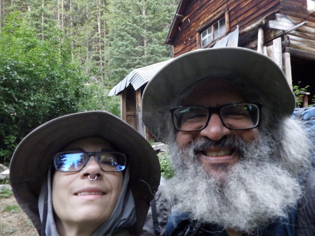
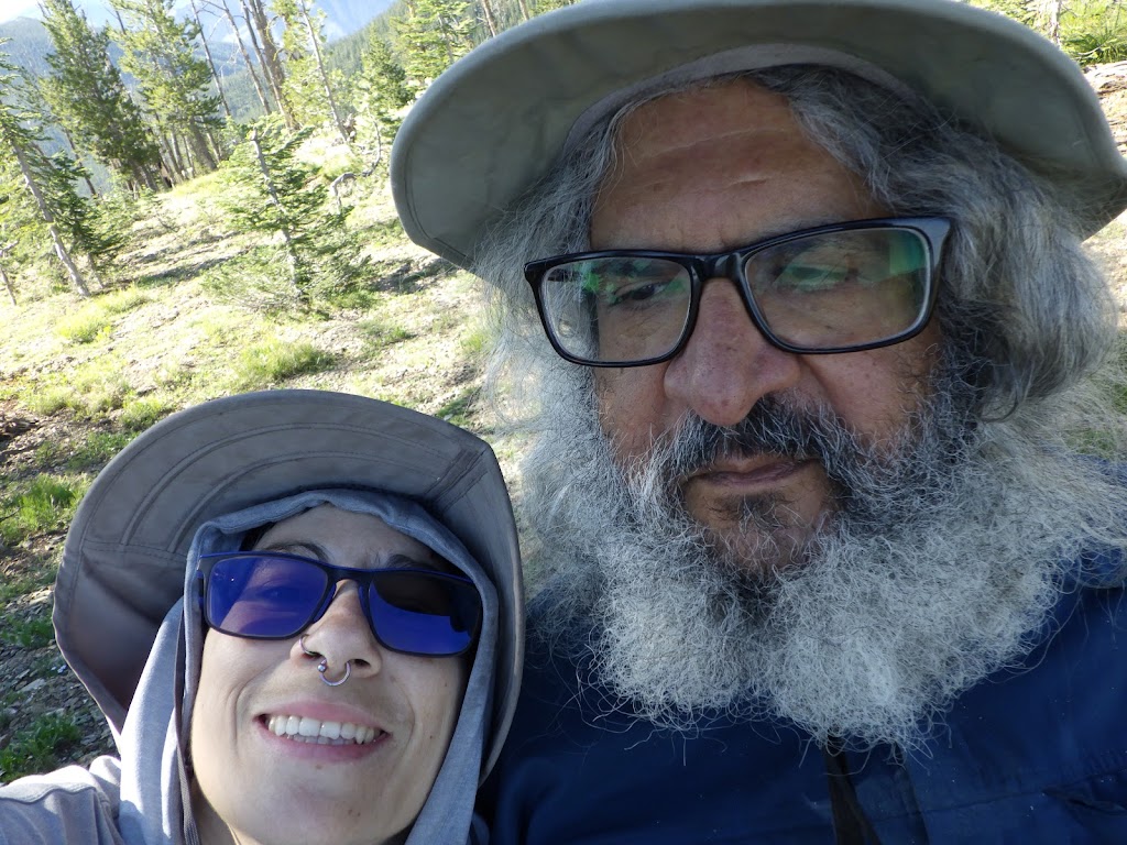
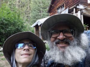
| Selfie! |
 |
| There’s a chipmunk hanging out on that log. |
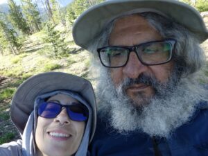 |
| My brother recently corrected me, so this one I’ll label an ussie. |
 |
| More bear grass coming down from the summit. |
 |
| That date has a year of 01! |
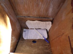 |
| Inside view of the permit box. |
 |
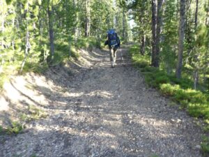
| On the road to Jeep Camp. |
 |
| This road was in even better shape than the road in the wilderness. |
 |
| It offered a few spectacular views. |
 |
| The rocky surface did make me walk a bit slower. |
 |
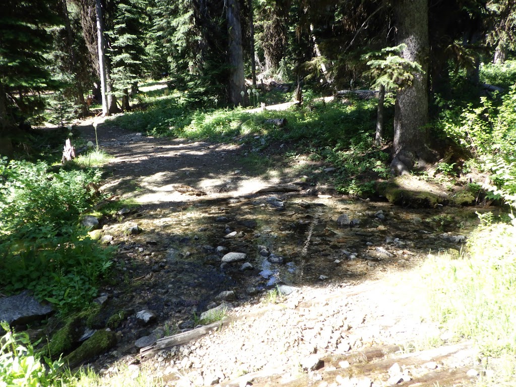
| Some water across the road. |
 |
| The last stream crossing. |
 |
| Pretty sure those bags shouldn’t be lying about torn open with spilled contents… |
 |
| This looks like it’s used as a stock area. |
 |
| Mosquito Ridge Trailhead is to the right. We made it! |
 |
| Woo! |
 |
| The trailhead sign rests at an awkward angle. |
 |
| I found a neat little knife! |