This time we approached Mount Heinen with a plan – and a knowledge of how long the trail was. The first part of our plan was to spend the night near the trailhead so we wouldn’t need to drive in the morning. Not only does that allow us to get an early start, but it allowed us to indulge in a night spent outdoors.
When we arrived near the trailhead, we drove down towards the reservoir to find a spot to claim. There was a decent spot available; not one that we’d want to spend a lot of time at, but usable for the night.
When we opened the car doors, we were greeted by the echoing calls of sheep. There was a huge flock up on the hillside, and they were quite vocal. A bit hard to hear on the video; you’ll need to take my word that it was much louder in person.
I found a flat enough spot to spread our tarp and we were pretty much set for bed before long. The sun was still up when we got comfortable on our sleeping pads, but it didn’t stay above the ridge for much longer.
However, the moon rose soon after the sun sank. I have rarely seen a cooler moonrise. It just crept up over the ridgeline like a spotlight, huge, full and bright. The water cast a rose-gold reflection like a path from the moon’s light.
 |
| Sheep on the hill. |
 |
| Moonrise. |
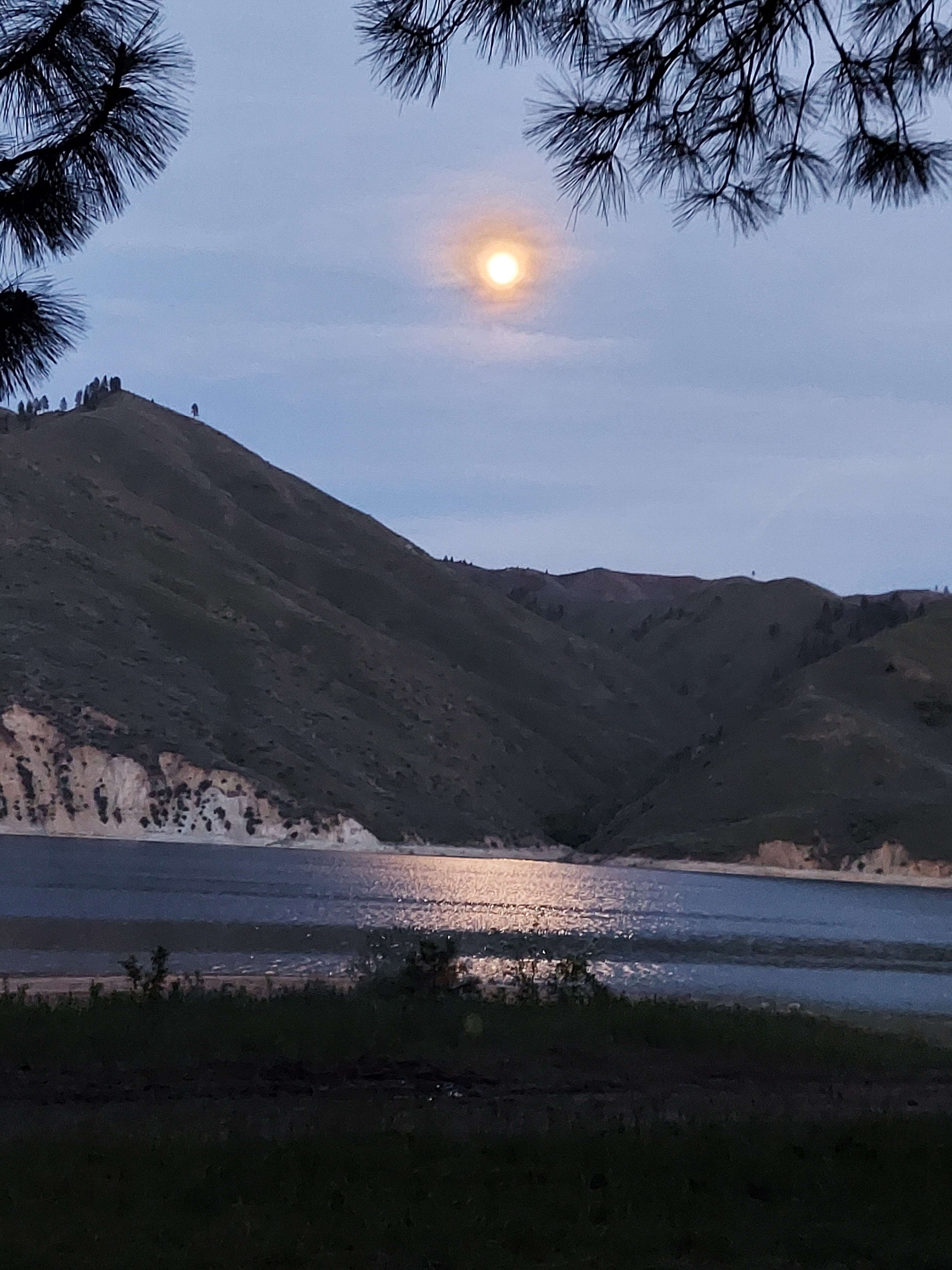 |
| Moonlight dancing on the water. |
I stayed up a bit too late reading, but I did get to bed at a reasonable hour, anticipating a 5 am wake up call. Ambrose wasn’t setting an alarm, but he didn’t really need to. He’s always waking up early! I trusted that he would wake me up right around 5.
Since we had both made an effort to stay hydrated, we both got up a few times in the night to answer calls of nature. On one of Ambrose’s, he saw people starting up the trail by headlamp around 4 am.
I was awake when Ambrose woke me, but I didn’t realize what time it was. I was just lying there considering whether I needed to get up to pee or could just go back to sleep for a bit. But sleep was not to be.
We got dressed and packed everything into the car. Then a short, if bumpy, drive to the trailhead parking. We ate breakfast in the car, and then started off on the trail. I realized as we began that I had forgotten to charge up all my equipment. My phone was only about 35%, and I wasn’t sure it would run for the whole trip with Map My Run recording my hike. My camera and my GPS were both down to their last bars. So I ended up taking less pictures than I normally might.
Just like last time, the first part was awful and steep. Lots of the trail is chewed up and difficult to hike. And there’s about 2000 feet of gain in the first two miles. That’s not easy. But I did it much faster than the first time.
I had planned on taking a break once I reached the first main plateau, but when I got there, I could smell and see that the sheep had been there first. The ground was a bit churned up, and I could smell the poop that I could see scattered about on the ground. Rather than putting my brand new sit pad on poop, I hiked on until I found a relatively clear spot to take a snack break.
Before my next break, two women came running down the trail. I stepped off so that they could pass, and when the second thanked me, I told her she was doing a great job. I could hear her, a moment later, say, “Yeah, we are doing a great job.” Soon after that, I took that break at the point that we’d turned back the last time. I didn’t take a very long break, just enough to rest my feet and eat a bit. Then it was time for new trail.
 |
| Starting before the sun rose. |
 |
| Looking back down; can you spot the tiny Ambrose? |
 |
| This part of the trail just inspires dread. |
 |
| Almost to the top of the first section. |
 |
| Trailside mushrooms. |
 |
| Time to start the new section of trail! |
Let the ridge walking begin!
Part of what made me turn back on the first attempt was seeing how much the trail went downhill before climbing right back up again. Now, I went ahead and descended, knowing that I’d have to climb back up. But the trail had several ups and downs in store for me.
I wasn’t too far from my break when I heard a voice behind me. Ambrose was in sight! And in hearing. He told me, from afar, that the runners were planning on running all four peaks of the Boise Grand Slam in one day. I was excited that he was so close behind me; uphill hiking hasn’t been his strong suit.
I thought the small double peak that was visible from my first few ridge walking hills was Heinen, but as I got close, I saw the trail actually went around that peak. And, as I could see that it was not going around to come up the back, I pulled out the GPS and discovered I was still almost 2 miles from Heinen as the crow flies (the GPS didn’t have this trail on it, so I could only get straight line distance).
Now if there was one thing I wasn’t expecting, it was to see another person coming down the trail. But what I really wasn’t expecting was to see a young man leading a small herd of horses towards me. Some of them had pack saddles on, but others lacked any gear at all. I waved at the guy and wondered what all those loose horses were doing. Maybe they were just going for a walk.
This trail, in addition to being completely switchback-phobic, seemed just determined to go over the top of every high point on the way up Mount Heinen. When I saw structures at the top of one, I thought I was reaching the peak. When I got there, I saw the structures were hitching posts (and I had to step over some barbed wire lying across the trail). I took out the GPS and… still not Heinen.
But I was getting closer!
Not long after that was a very challenging downhill section, very steep. I had tightened up my Lems Boulder boots a lot, but I found that the tightness higher up on my ankles didn’t work very well on the downhill sections. The leather dug into my ankles a bit, and I knew two things. One, I was going to be sore there, and two, I needed to figure out a better lacing strategy after I turned around.
My next GPS check wasn’t so much to determine if the peak I was currently on was the peak, but rather to see if I could use the map to determine which of the peaks looming ahead was Heinen. And I was able to determine, at last, my target point.
It’s funny how a hike can go a bit faster when the end is in sight. I still had a good bit of climbing to get through, but it went smoothly. And I finally got to the peak, marked by not one, but two benchmarks. One from the USDA and one from the USGS. There was even a peak register for me to sign! I haven’t had the pleasure of signing many of those. Kind of makes me hungry for a few more peaks in my life.
From the peak, I could see Ambrose making his way up. I decided to wait, on the very windy peak, until he arrived so I could get a picture of him at the top. And he ended up being only 13 minutes behind me! I feel like it won’t be long until he’s hiking faster than me again, if I don’t keep up with my training.
 |
| Ridge walking! |
 |
| Horses on their way down to the road. |
 |
| I thought I could see Heinen from here, but I was wrong. |
 |
| Snow on the distant mountains. |
 |
| Hitching Post Hill – also not Mount Heinen. |
 |
| Almost there, that’s Mount Heinen on the far left. |
 |
| A bit of snow near the peak. |
 |
| USDA Benchmark |
 |
| Peak Registry! |
 |
| USCGS |
 |
| Mountain selfie, with accidental perspective lines. |
 |
| I signed the registry! |
 |
| Proof Ambrose made it to the top – and only 13 minutes after I arrived. |
We started back together, finding a place out of the wind to take a break, but Ambrose wanted to eat lunch, and I preferred just to have a bar and keep hiking. These training hikes are supposed to be harder than what we plan to do backpacking, so I push myself. I hadn’t gone far before I came upon another hiker and his dog.
I ran into several more people as I continued back to the car. A pair of older gentlemen, and then a younger couple. I chatted very briefly with each as we passed. Then I saw a larger group up ahead of me, a mix of men and women. One of the women looked familiar, but I thought to myself, there’s no way that’s my old coworker.
So when I walked by the group, I didn’t even look at that person until I heard my name. It was my former coworker! I was so excited I gave her a great big hug, and then spent several minutes chatting with her and her group. I let them know that my husband was behind me and reminded her of his name so she could “freak” him out by saying hello by name (which she did, and he was startled).
The horses and their boy passed by again, going in the opposite direction. Ambrose asked if he was with the shepherds and the guy said yes, but for a different flock than the one we heard bleating on the hill near the reservoir.
From there, I kept expecting the turn back towards the car to be just over the next hill. I had mentally divided the trail into four sections. First, the front, which was about the first mile straight up from the car. Next, the traverse, when the trail took a left after the front and before it took the right towards Heinen. Then the front back (between the traverse and going around those two little peaks) and the back back (once Heinen was in sight). And every summit I crested seemed like it was the start of the traverse again, until I saw yet another downhill section.
The good part about the downhills was that I got to have another section of uphill after them. Which was good, because Ambrose was actually in sight behind me before at my last break before I reached the traverse! I mean, I did give him some time to catch up, what with the long chat with my former coworker. But he was actually catching me, and I knew he’d be faster on the purely downhill sections coming up. I had to skeddadle!
I’d figured out that undoing the top two lacing holes on my boots made downhill hiking much more comfortable on my ankles, but the toes of my right foot got into a banging position and I had a hard time not aggravating them on the downhill sections. I wondered how much of it was the boots and how much of it was that this was simply a rough trail to hike. Next time, I’m going to use my Altra shoes and see how they do when it comes to my toes.
 |
| More snow visible once I turned around. |
 |
| Barbed wire across the trail. |
 |
| Rolling along the ridge. |
 |
| Getting back in sight of the water. |
 |
| The horses came back fully laden. |


After I reached what I called the traverse section, I ran into two more hikers along with two dogs, and I chatted briefly with them about the Grand Slam peaks before continuing on. I was so close to the end, I could feel it. I just needed to keep myself from falling down, which wasn’t entirely easy. The trail, by this point, was quite dry and dusty, making traction on some downhill sections hard to come by. I almost fell once, but managed to catch myself with my trekking poles.
Once I got to the car, I looked up at the trail. I could see Ambrose making his way down off the front. So I got in and drove off. Literally. But I didn’t go far 🙂
I drove myself over to the nearby pit toilet to use the facilities, and then drove back to wait for Ambrose. I even left the car running because he was very close, and I was very hot. The AC felt great!
My body felt absolutely wrecked, but I was able to drive us home. And I was very grateful that the trailhead was only an hour’s drive from home rather than the three to four that our usual training hike is. And now that I’ve done the peak once, well, I can’t wait to do it again and see how fast I can go now that it is a known trail.
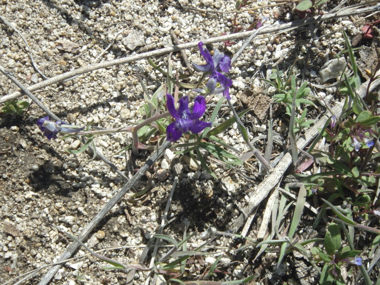 |
| I love these flowers! |


 |
| The sheep were still on the hill, making a ruckus. |
 |
| So close, yet so far away from the car… |