If any day was going to be called an easy day, this might be the one. We were only going to travel from South Sandpoint to North Ozette. The only tide impacted section we needed to cross was Wedding Rocks. And while Wedding Rocks absolutely kicked our butts the very first time we hiked it, we knew better now. No more climbing at Wedding Rocks!
I suppose we could have slept in on this day, but we decided to get up at the 4 alarm this time, because if there was any chance of us hiking all this in one tide cycle, it would be by getting up extra early. It was still very dark when we were getting ready to leave, because of the thick tree cover at the campsite. Now, normally, I wouldn’t take pictures or film anything when it’s that dark. But on this morning, we received some camp visitors, and I just had to bring out the GoPro.
Using my headlamp, I managed to catch a mouse in the act of going after Ambrose’s breakfast. And then I used the GoPro, trying to keep my headlamp on the mouse as it scampered around the campsite and then burrowed itself a hole while I watched. So cool! And definitely a sign that staying more than one night at South Sandpoint would require vigilance against such camp robbers.
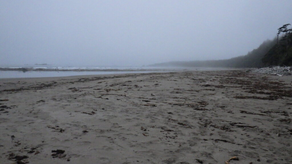
We managed to avoid feeding the wildlife, and then climbed down the bluff with rope assists. There was a lot more light on the beach, but no sunshine. The first three days featured a lot of sunshine and clear skies, as if Mother Nature were allowing us to acclimate before bringing on colder, wetter weather. But I was happy to see the mist on the beach.
I love walking through clouds, and on the coast it’s even more special. Sounds are a bit muffled, but the ocean waves persist in their crashing. This wasn’t fully a cloud, but the mist ahead did veil Sandpoint, and wreathed the trees up on the bluff. The wind blew droplets into our faces. The sand was damp and provided an excellent walking surface.
We hiked from South Sandpoint to the southernmost campsite of Sandpoint. There were a couple of tents on the beach ahead of us, as well as the point itself, but we made a strategic decision to cut through instead of going all the way to the point.
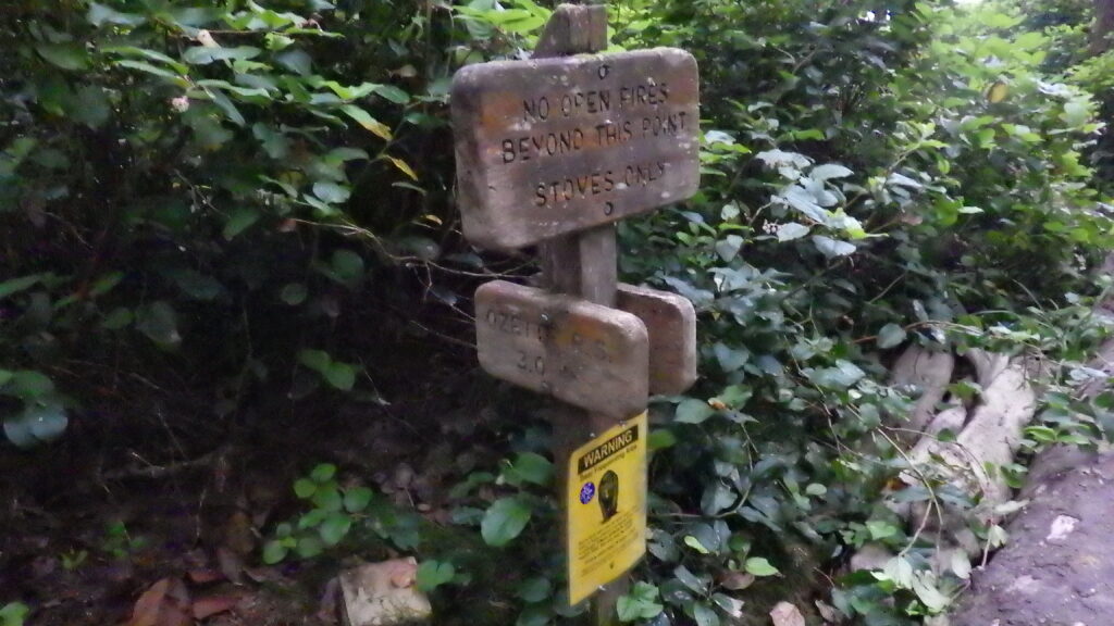
The Sandpoint campsite stretches from where we were, around the point and about as far on the other side, like a shore-hugging boomerang. There’s a trail in the woods that provides a path to the campsites, the water, and the privy, and that’s what we took.
Not only does the cut through trail give us a shorter distance to hike, we can avoid the soft sand near the point. And the trail has a nice soft, but resilient surface. Other than the myriad roots growing across it, it’s a perfect trail. The roots do downgrade it a bit, you still need to watch your footing on this trail.
I wasn’t sure how the trail would be marked on the far side, since I hadn’t taken the full cut through before, but Ambrose had. And it was very clearly marked. Keep hiking straight, you’re headed to the ranger station in about 3 miles. We turned left, making our way alongside a campsite. There were tents in it, and people stirring inside those tents, but no one out and about.
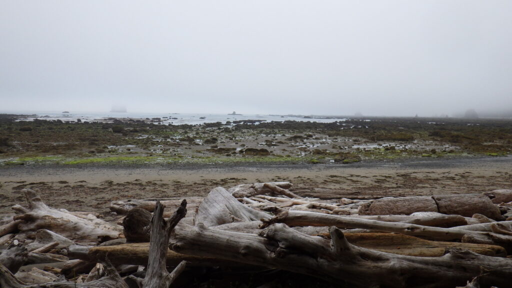
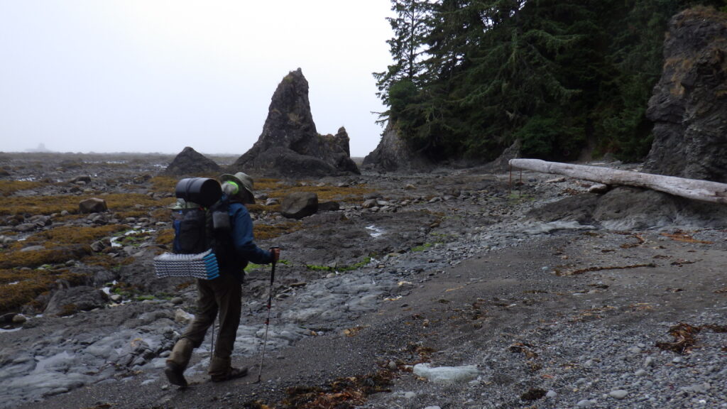
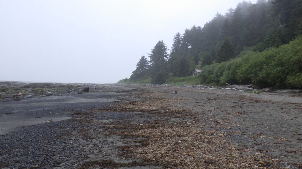
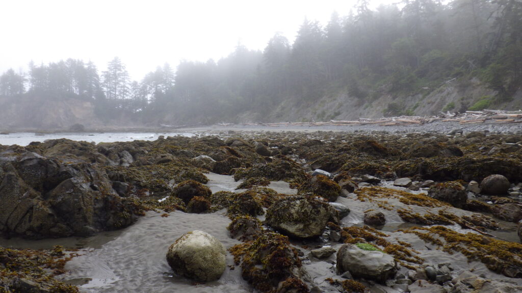
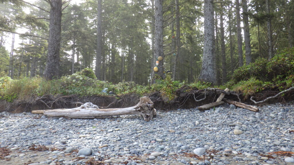
We made it back to the beach, but the sound of the waves was quite muted, because the tide was extremely low. Our sand walking didn’t last very long. The beach on this end gave way to gravel rocks, which are absolutely draining to walk on. It’s like walking on soft, dry sand, but it’s damp. Feet sink with each step and traction is lost on the push off. That was probably the roughest part of the day, any time we had to walk on that loose, rocky sand.
For a change of pace, we got to walk on wet rocks instead, going around the first point that leads to Wedding Rocks. There is an overland trail to skip this section. In fact, we’ve taken it before (Ambrose under great protest). That’s how we know that the climb is a LOT and that we don’t want to take it unless it is necessary. With the tide being so low, there was no need to go up.
Between that rock and the next point, we hiked along more of that awful rocky beach. I was in the lead for the most part (Ambrose would catch up when I stopped too long for photos or to pee). I found that walking the line where the dried seaweed met the rocks often provided the best traction for my feet. Not always, but often enough that I sought it out. That helped me get most of the way to the second point.
And rather than walk the whole way along the beach, I took advantage of the low tide and struck out on a straight-line low-wet route to get around Wedding Rocks. No need to worry about getting my feet wet with waterproof socks on. Ambrose’s boots were waterproof, but any water higher than his ankles would flood his feet, so I kept that in mind as well when traveling. The last two times we’ve gotten to this point, we have climbed up at some point. Not this time! We stayed low and made it around with ease.
After that, campsites start to appear in the trees. The beach is still rough and rocky, but there’s water somewhere and people were stirring in some of the campsites. At one campsite, I thought I saw a woman alone, but she wasn’t quite alone. She had a baby with her! I was stoked, I thought that was so cool. Not something I would ever do (no kids in the cards for me), but good for her!
She was about ready to head out, and I later saw her almost catching up to Ambrose when I’d pulled ahead. We weren’t all that far from Cape Alava at this point, and while I was kind of interested to talk to her, I was far more urgently interested in getting to the privy at Cape Alava.
So urgently interested that I forgot that I should go towards the trail to the ranger station so that I can get to the path to the privy. Instead, I forged ahead, forgetting that we were there so early that most folks would still be waking up or eating breakfast. All the campsites were full, so I chose one to sneak through that had awake people getting ready to leave. The kids stared at me, but I didn’t mind.
When I got to the privy, there was a line. Three women ahead of me. I put on my zen face and waited patiently, listening to the ones waiting for their friends chat. One of them mentioned that her back was sore, and I shared my favorite stretch to ease my back while backpacking, which is to give yourself a hug with swinging arms. Feels great between the shoulder blades.
Before too long, I got to see for myself what this privy was like. I knew there was something weird about it, because I kept hearing this cranking sound when the women ahead of me finished. Inside, I saw that it was a urine separator toilet. That turned out to be the oddest pit toilet I’ve ever seen. The user’s output falls onto a tilted surface which allows urine to drain towards the front while anything else clings to the surface. After one’s business is complete, a foot operated pedal moves that surface conveyor-belt style up and to the rear where it gets dumped. It was the least smelly of all the pit toilets, and I appreciated that.
I mean, yes, it did smell like a pit toilet, but it lacked the extra nose-curdling sharpness of the other ones. An improvement.
When I’d finished my business, I made my way back to Ambrose and the beach. We weren’t quite to the good walking surface, but it wouldn’t be long. I heaved my pack onto my back – with extra care, because I didn’t want to put unnecessary strain on my repair job – and we started to make our way to the better damp sand ahead.
Not far from the camping area, there is an old ranger station up on the bluff. And just past the ranger station is the Osett Memorial. I have tried to get Ambrose to climb up and look at the memorial every single time we passed it. Even on the way back in 2018, he chose to keep hiking instead of taking the time and energy to hike up to the bluff.
This year, I didn’t even need to wheedle, let alone whine. We pulled over, dropped our packs, and hiked up. I took the direct route, while Ambrose found a trail that wasn’t quite so steep. And then we went inside, where a plaque proclaims the memorial. There are many bones inside, as well as old fishing gear. It’s been a little different each time that I’ve seen it, but I’m always fascinated.
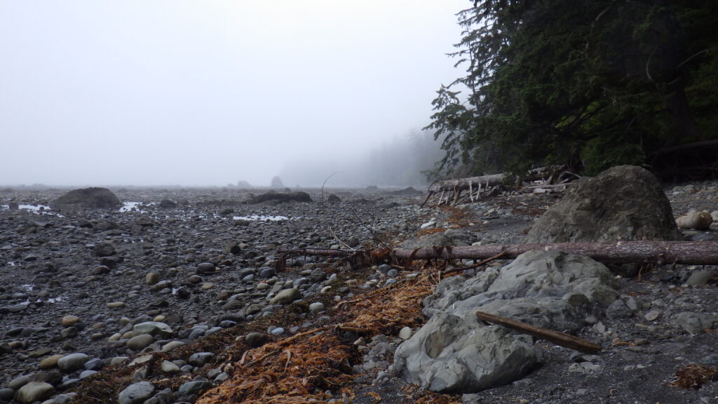
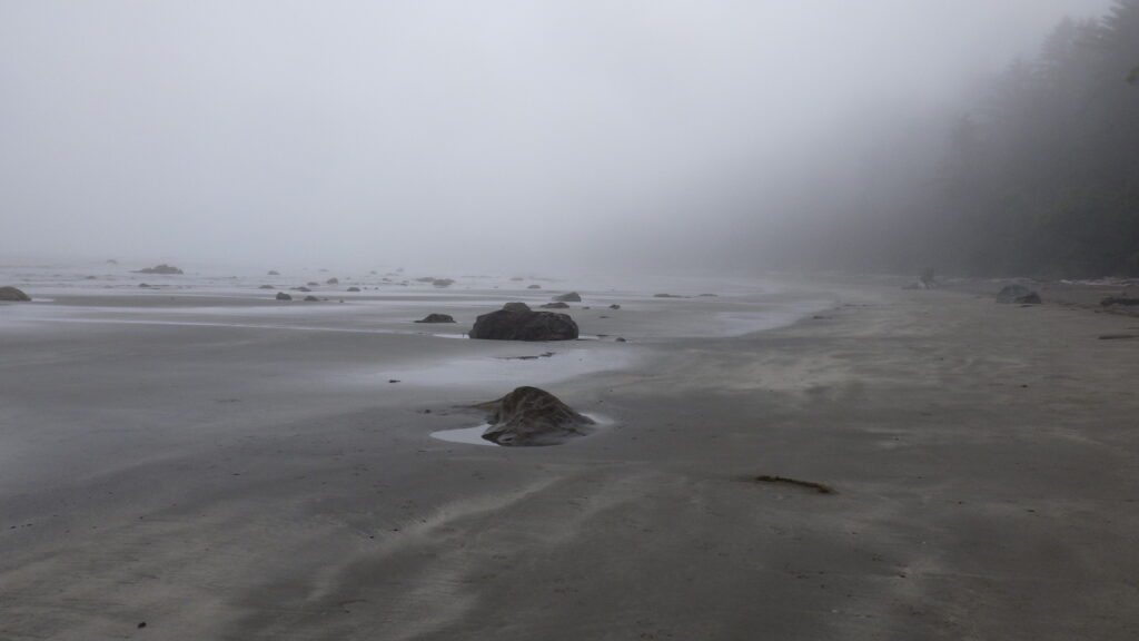
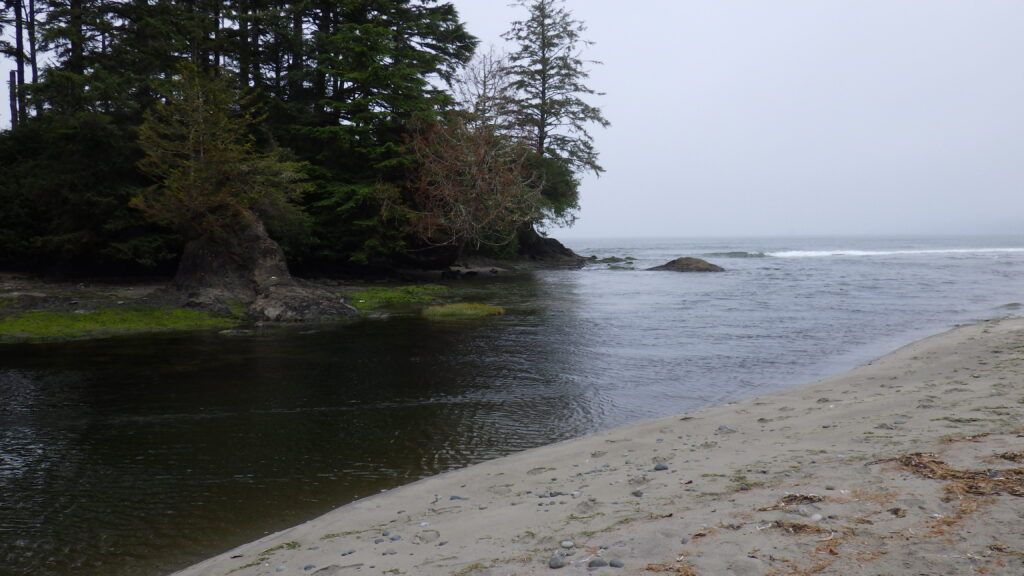
We didn’t linger since we did have a river to cross, and the hope that we might make it before the tide prevented progress. The damp sand welcomed our feet soon after, and we started moving fast, though it was hard to judge how fast.
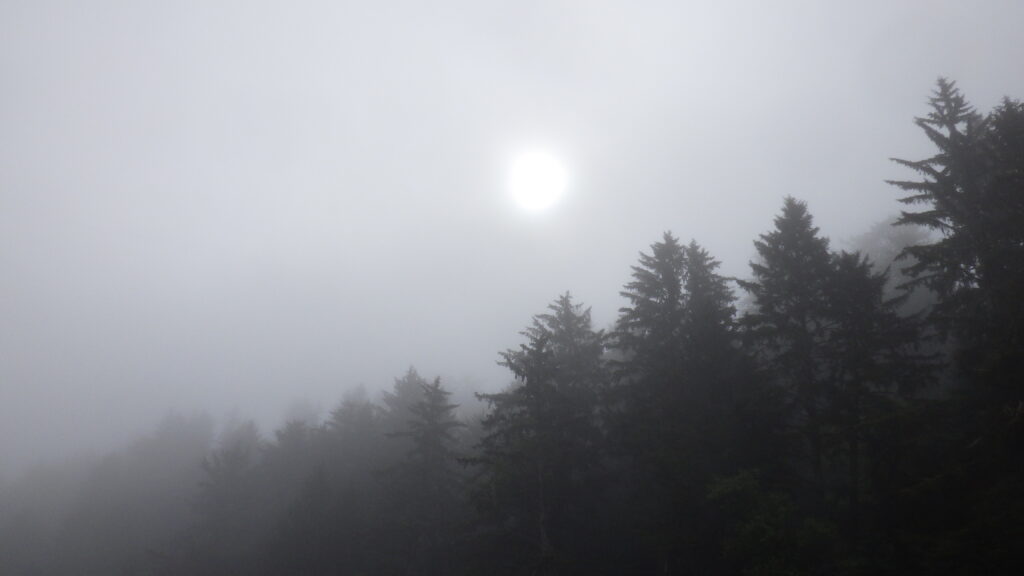
See, it’s hard to gauge distances when you’re walking through a cloud. While we’d been walking through a bit of a marine layer all morning, after we rounded the point past Cape Alava, we were truly walking through a cloud. On the bluff to my right, I could see the trees on the bluff, but they were kind of blurred into a dark green mass. The sun had risen above the tree line, but the only sign of it was a disc of brightness in the thick gray clouds overhead. The tide was still far enough out that the sound of the waves was muted.
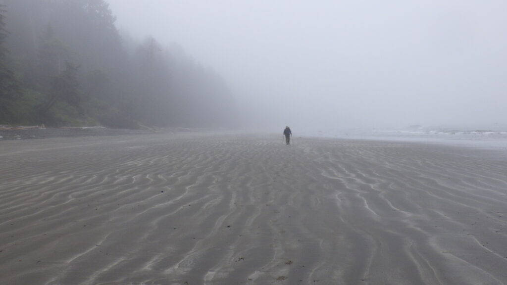
My legs felt great, moving like clockwork across the smooth surface. I thought that Ambrose would be far behind when I turned around, maybe even lost in the mist, but he wasn’t that far behind me.
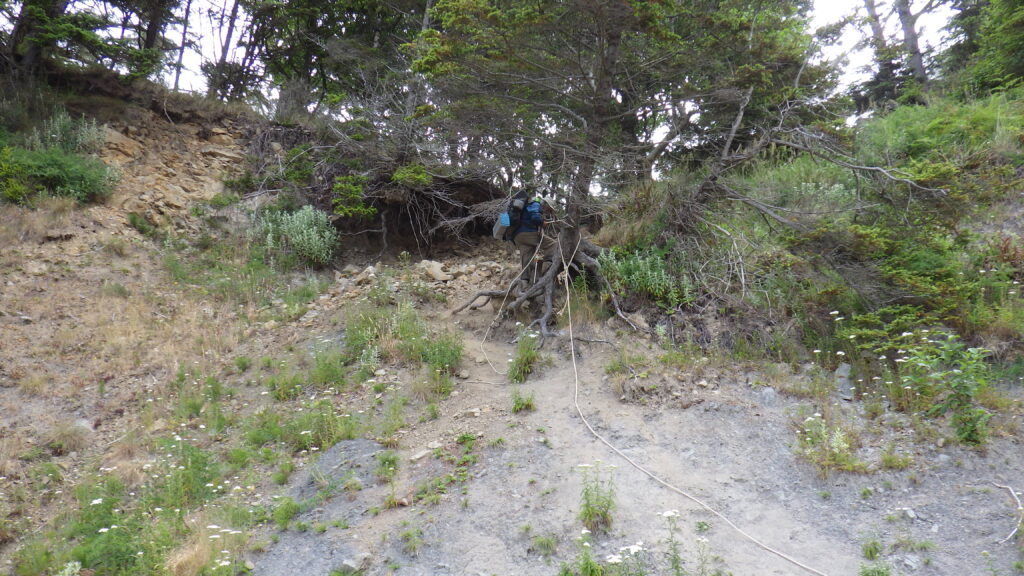
Since the sound of the waves hadn’t been penetrating very much, I was surprised to find that we couldn’t round the second little point along this stretch of the coast. There was a potential high route, but it would have required us to climb up to a ledge about 6 feet high with essentially no steps or footholes since it was an overhang. Luckily for us, this point had a roped overland option.
And we were both feeling energetic enough to take it rather than wait the tide out at this point. Ambrose went up first, testing the ability of the rope to hold onto his weight. If it held for him, it would definitely hold for me. I’m not entirely comfortable that he’s always the guinea pig for these rope climbs, but I can’t argue the logic.
Ambrose made his way up the rope without any issues. It was a bigger climb than our first overland, but still relatively straightforward. Up and over. I waited at the top while Ambrose went down using the rope. There was a little trail that looked like it led off into the bluff, and I wondered if it led to the South Ozette campsite. After Ambrose was down, I decided not to go down backwards. I only used the rope near the top as a balance aid going down face first, and then I switched to trekking poles at the bottom. Hard core to the bone!
We had just one more little point to navigate before the river crossing. And, technically, we could have gone around it by taking the trail up to the South Ozette campsite, but the water was low enough that we continued onto the rocks.
And just when we were on the slickest section of rocks, where a high step was required, a woman came around the corner and lended Ambrose a hand up. She was wearing water socks, which are kind of like a combination of the waterproof socks I was wearing and the sole of my boots. I asked her about how they were doing and she gave them a good review. She carried on towards Alava and we finished rounding the point to find her companions, 6 more people who had just finished crossing the Ozette River, which still looked eminently crossable.
They started to make their way around the point while Ambrose and I pointed ourselves at the river. It looked no more than knee deep, with a rather vigorous current headed out to the ocean. We lengthened our trekking poles, and then I waited at the shore while he made his way across. The depth was nothing to worry about, and I followed with no problem.
It was nice not to have to take my boots off at the crossing. My feet stayed dry inside their layers, while my calves got soaked. And then we were home for the day. In one tide cycle!
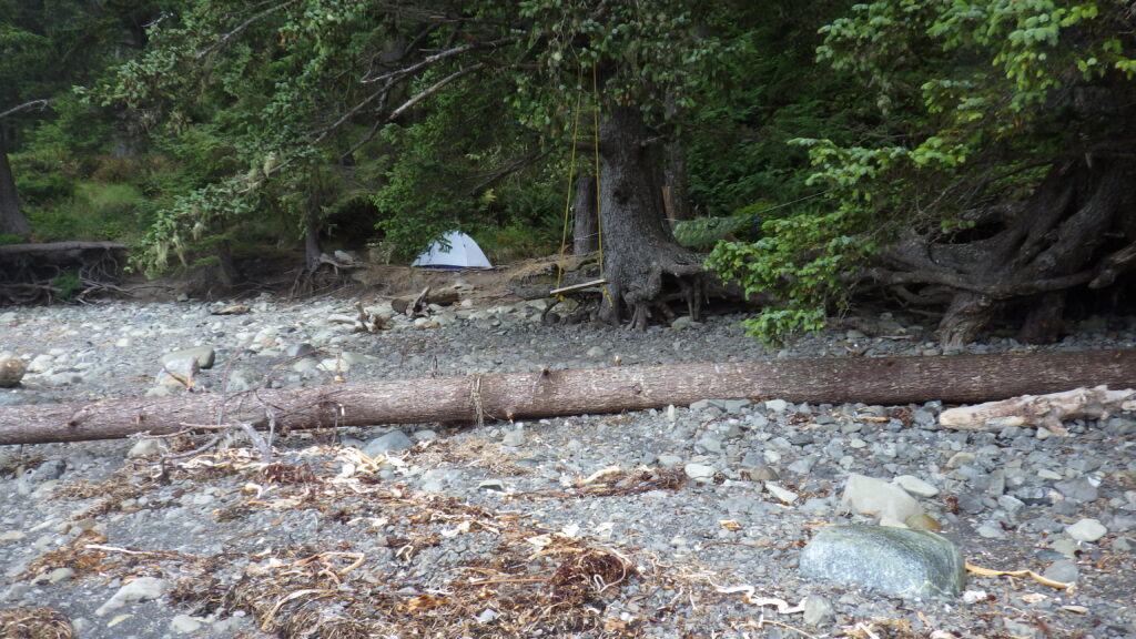
We headed towards the end of the campsite before making our way up onto the bluff where we knew the privy trail was. Heading away from the privy, we came upon a group of women starting to pack up their camp. I joked that we’d just wait and take their site, but we kept going to explore the remaining sites.
We ended up at a campsite that had been fully occupied the last time we’d been there. It had a fire pit, benches all around said fire pit, a nice spot for a tent, and, what turned out to be most important, shelter from the unceasing wind. We plopped down our packs and settled in.
The rest of the day was spent on camp chores and exploring. I made some recordings, including a tour of the route to the privy. We walked along the river at high tide. I figured out that the tea tree balm I carried was just the thing to neutralize the stickiness of a blob of pine resin I’d managed to pick up from one of the trees I’d stepped over at some point crossing Wedding Rocks. It had started to irritate my skin by binding my pants to my skin, but the balm made everything unstick (though I’ll likely never get the stain out of those pants).
I even managed to take a nap, which I needed after a couple of nights of not great sleep. The ground at South Sandpoint was hard, and my hips kept waking me with complaints.
It was amazing how much the wind would get cut when one was sitting at the fire pit as opposed to standing about five feet away from it. The clouds remained all day, though the wind helped us dry out some of our wet items, especially my boot liners and Ambrose’s socks.
Through the afternoon, more groups arrived, each one popping a look at our site and leaving with pure envy when they saw it was occupied. We were the early birds again, plucking the juiciest worm.
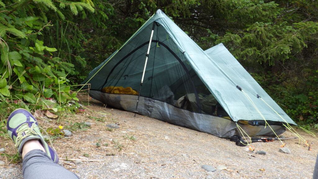
After dinner, we settled into the tent to stay warm and dry. The tent was in the wind, which blew moisture across it all night. The warmth of our tent caused a lot of condensation on the inside and the outside of the tent, but we did stay nice and cozy warm in there.